
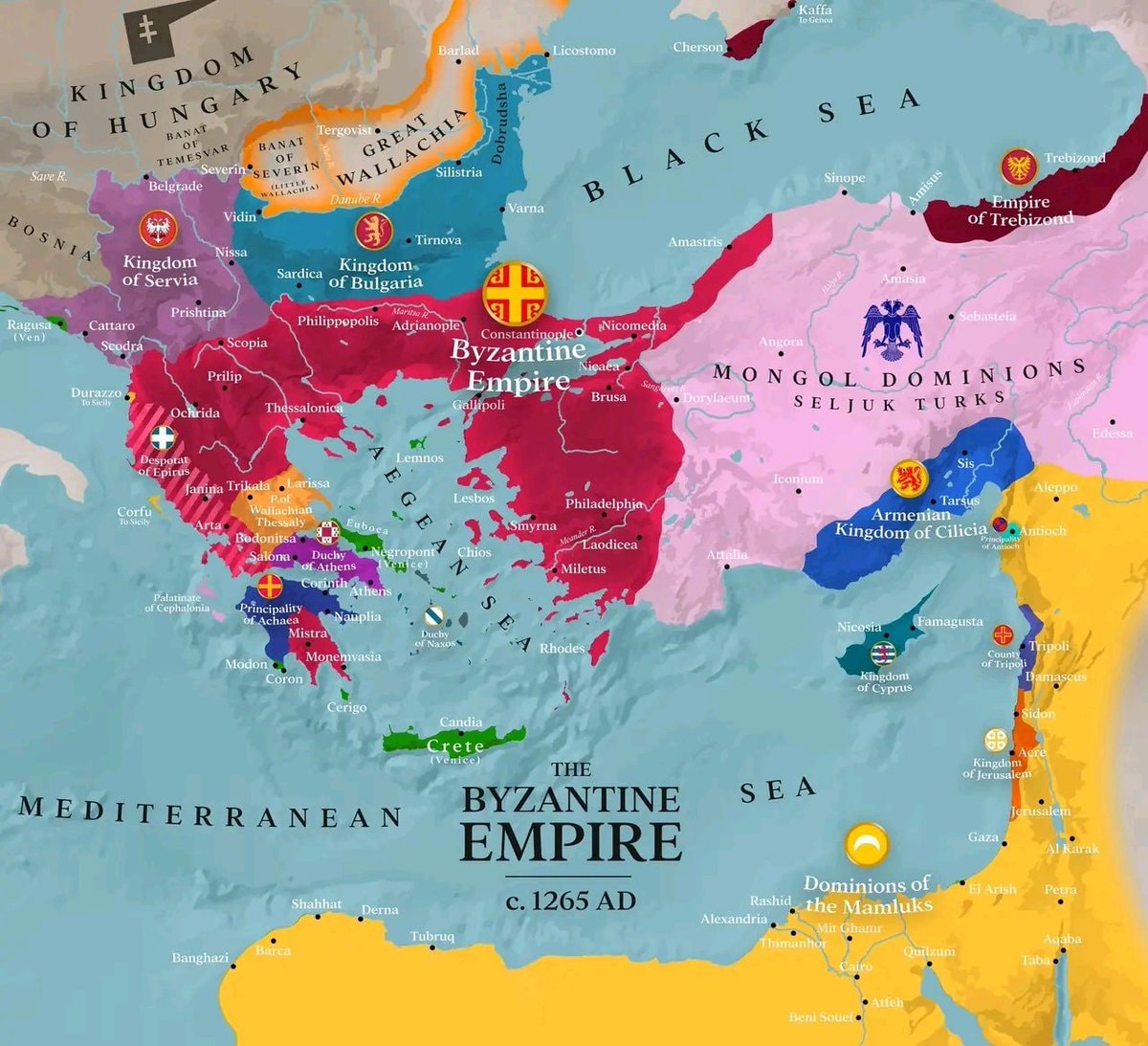
@savageupdatesThe Byzantine Empire existed around 1265 AD
Ver publicação original@savageupdatesThe Byzantine Empire existed around 1265 AD
Ver publicação originalFoto de @savageupdates· Oct 6, 2026· Info/Editorials
This is a historical map depicting the Byzantine Empire around 1265 AD. The focus is on the territorial extent of the Byzantine Empire and its surrounding political entities. The map uses distinct colors to differentiate between the Byzantine Empire, the Kingdom of Hungary, the Kingdom of Serbia, the Kingdom of Bulgaria, the Mongol Dominions of Seljuk Turks, the Armenian Kingdom of Cilicia, the Dominions of the Mamluks, and other smaller principalities and duchies. The overall style is informative and educational, typical of historical cartography. A notable detail is the inclusion of various city names and geographical features like seas and rivers, along with emblems for some of the larger political powers. The on-screen text clearly labels "THE BYZANTINE EMPIRE c. 1265 AD".
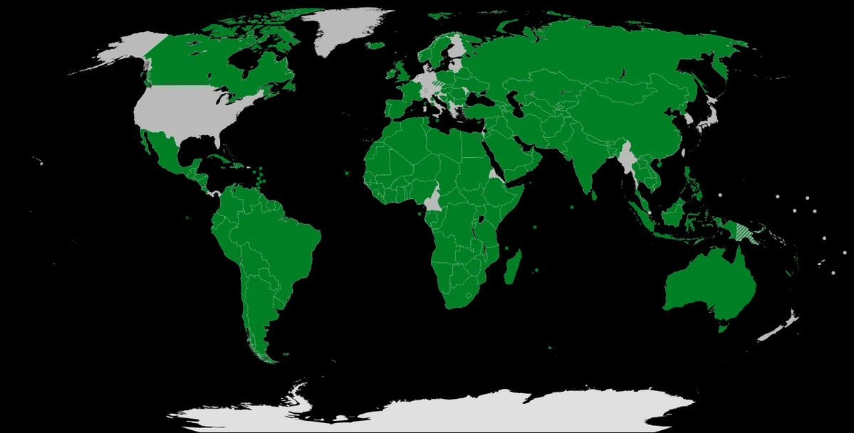 global recognition of Palestine
 Angel Falls vs Burj Khalifa height
 local beer brands of Europe
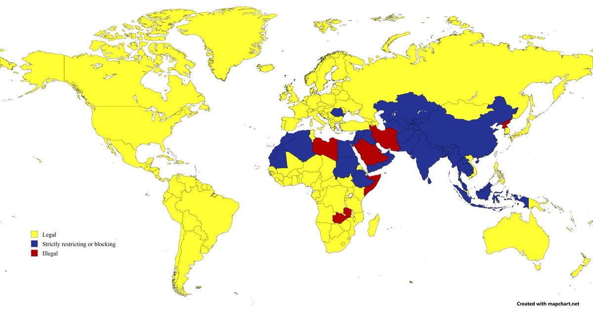 countries where pornography is banned
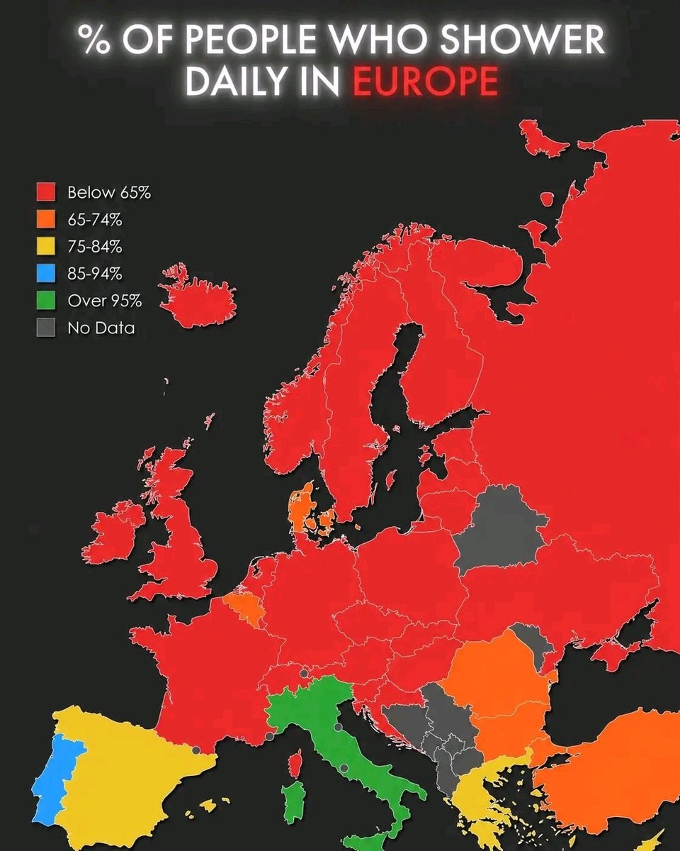 daily shower rates in Europe
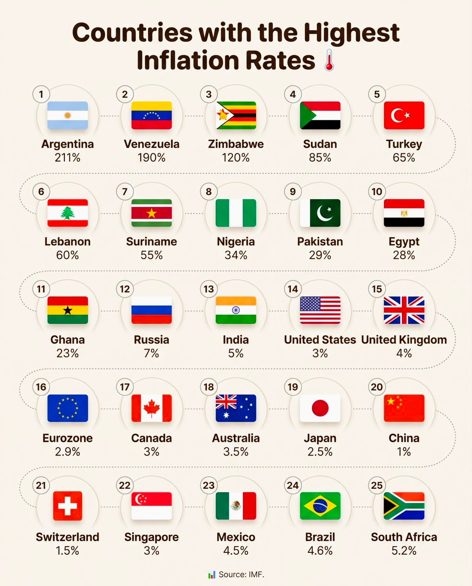 Highest Inflation Rates by Country
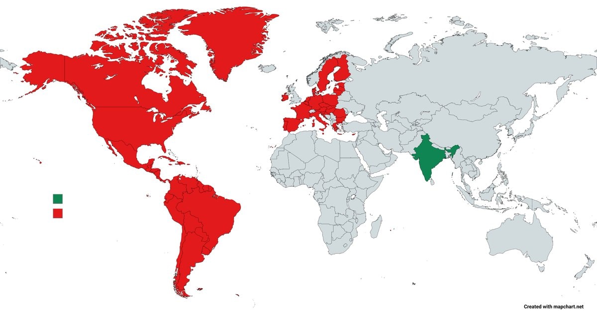 world map red green population balance
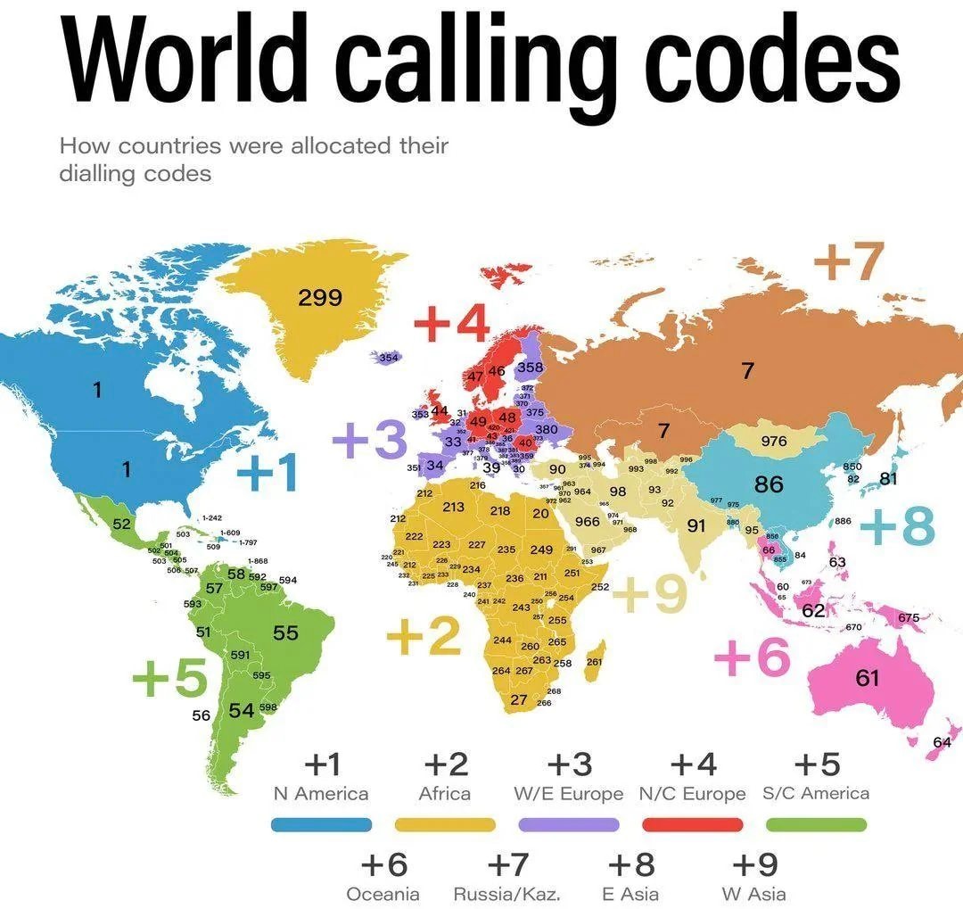 World Calling Codes
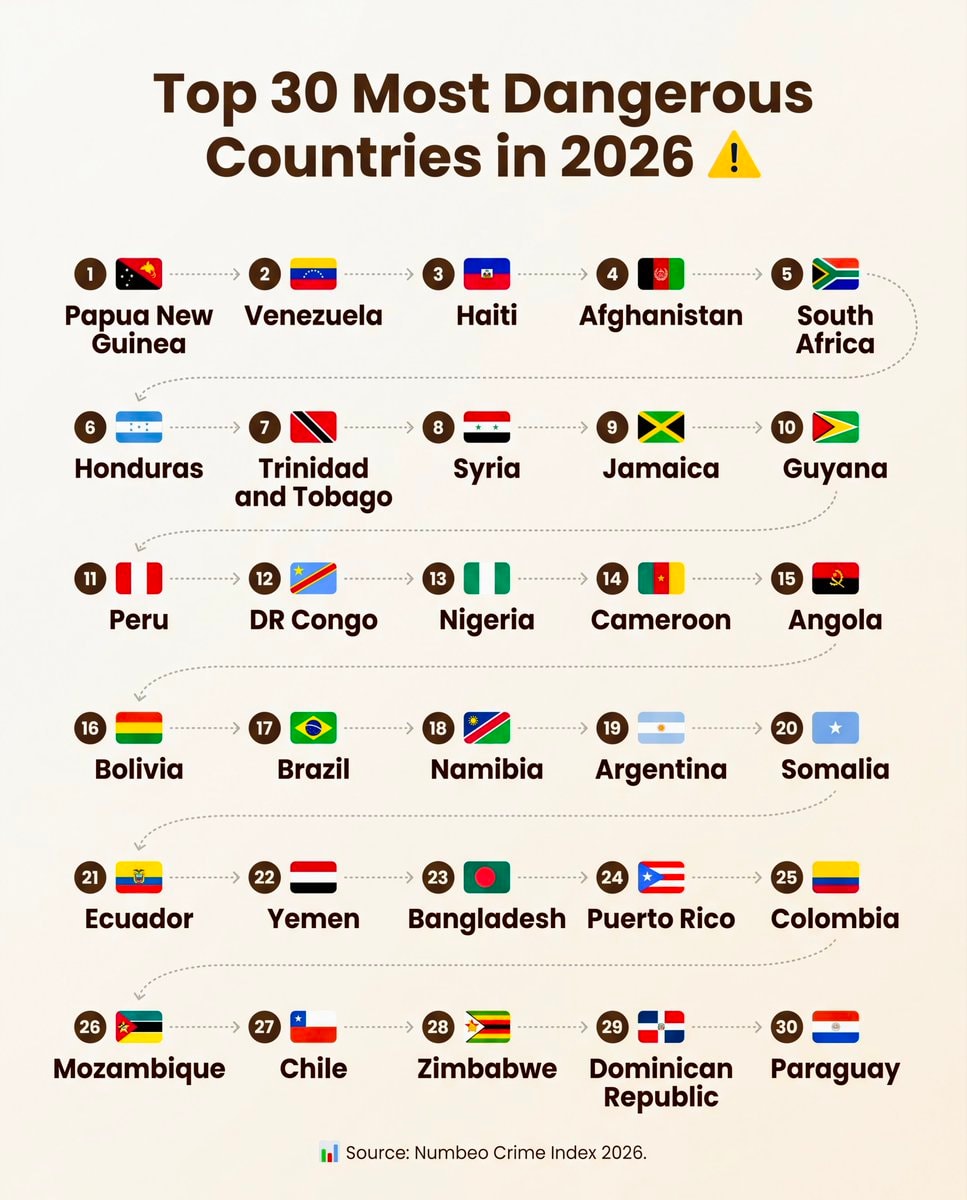 Top 30 Most Dangerous Countries in 2026
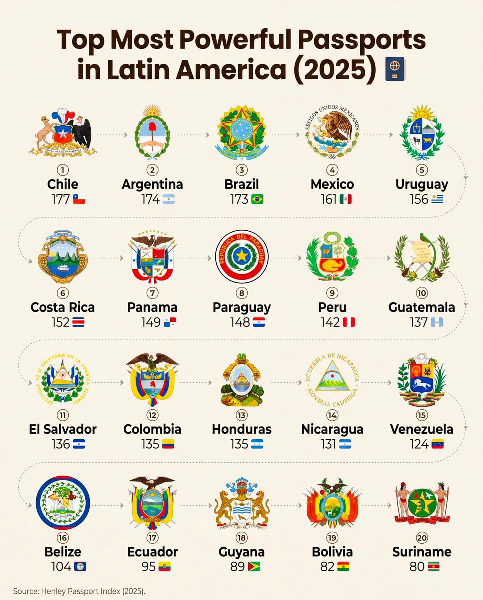 Latin America passport rankings 2025
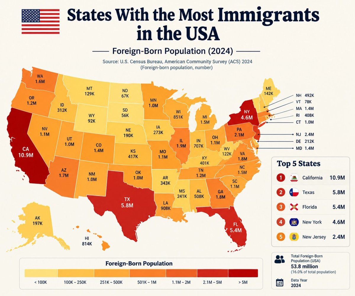 US States Immigrant Population Ranked
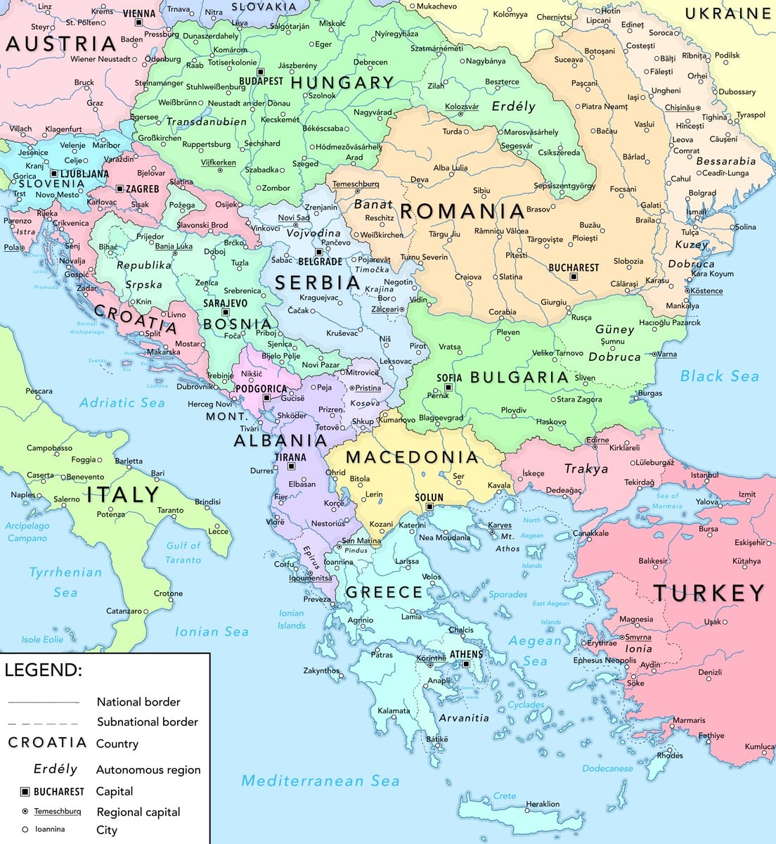 Balkans fair division 2026
 tea vs coffee countries map
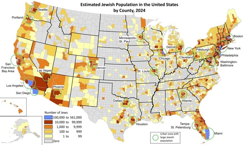 Jewish population by U.S. county
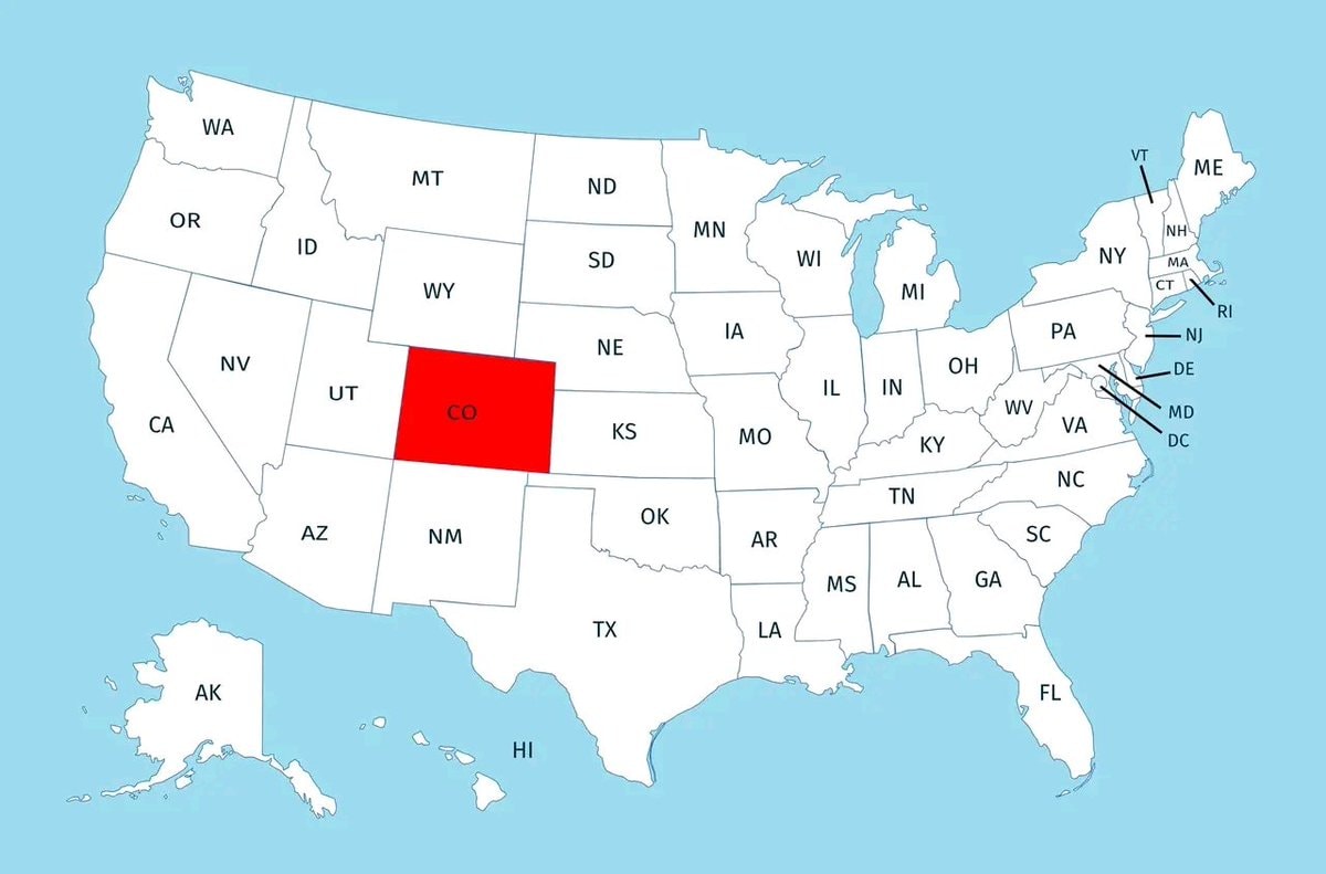 US states above 1000 meters
 wedding costs by state
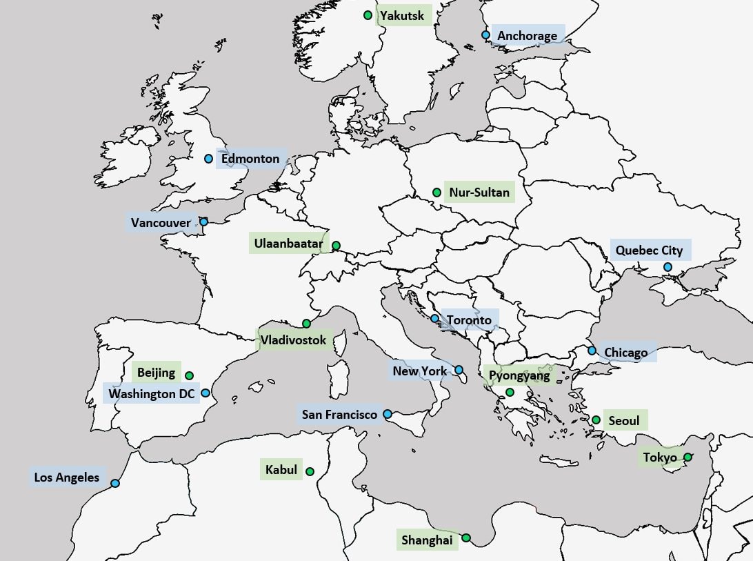 World cities aligned with Europe latitude
 Richest Cities by GDP 2025
@savageupdatesThe Byzantine Empire existed around 1265 AD
Ver publicação originalFoto de @savageupdates· Oct 6, 2026· Info/Editorials
This is a historical map depicting the Byzantine Empire around 1265 AD. The focus is on the territorial extent of the Byzantine Empire and its surrounding political entities. The map uses distinct colors to differentiate between the Byzantine Empire, the Kingdom of Hungary, the Kingdom of Serbia, the Kingdom of Bulgaria, the Mongol Dominions of Seljuk Turks, the Armenian Kingdom of Cilicia, the Dominions of the Mamluks, and other smaller principalities and duchies. The overall style is informative and educational, typical of historical cartography. A notable detail is the inclusion of various city names and geographical features like seas and rivers, along with emblems for some of the larger political powers. The on-screen text clearly labels "THE BYZANTINE EMPIRE c. 1265 AD".
Ainda não há comentários. Seja o primeiro!
global recognition of PalestineAngel Falls vs Burj Khalifa heightlocal beer brands of Europecountries where pornography is banneddaily shower rates in EuropeHighest Inflation Rates by Countryworld map red green population balanceWorld Calling CodesTop 30 Most Dangerous Countries in 2026Latin America passport rankings 2025US States Immigrant Population RankedBalkans fair division 2026tea vs coffee countries mapJewish population by U.S. countyUS states above 1000 meterswedding costs by stateWorld cities aligned with Europe latitudeRichest Cities by GDP 2025
Ainda não há comentários. Seja o primeiro!