
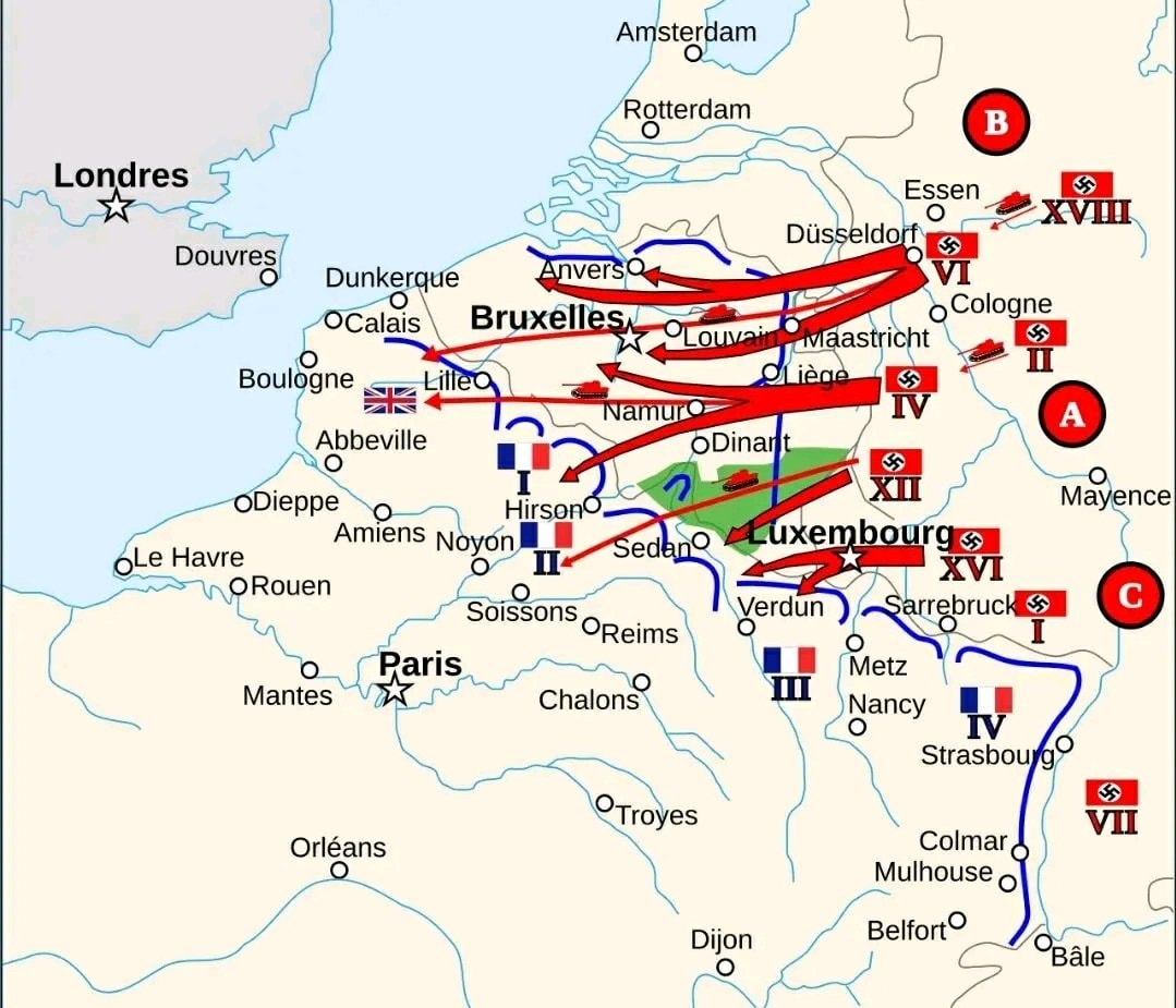
@savageupdatesGermany formulated a plan for invading Western Europe in 1940
Ver publicação original@savageupdatesGermany formulated a plan for invading Western Europe in 1940
Ver publicação originalFoto de @savageupdates· Sep 27, 2026· Info/Editorials
The image is a historical map depicting military movements in Europe. Red arrows indicate German advances across Belgium and Luxembourg towards France, with tanks shown as symbols of military force. Blue lines represent Allied defenses, particularly around Paris and in northern France. The map is styled as an informational graphic, likely for educational or historical context. Notable elements include the flags of France and Germany, and the cities marked with stars, such as London, Brussels, and Paris, indicating key locations. The map is divided into sections labeled A, B, and C, with Roman numerals denoting army groups or corps.
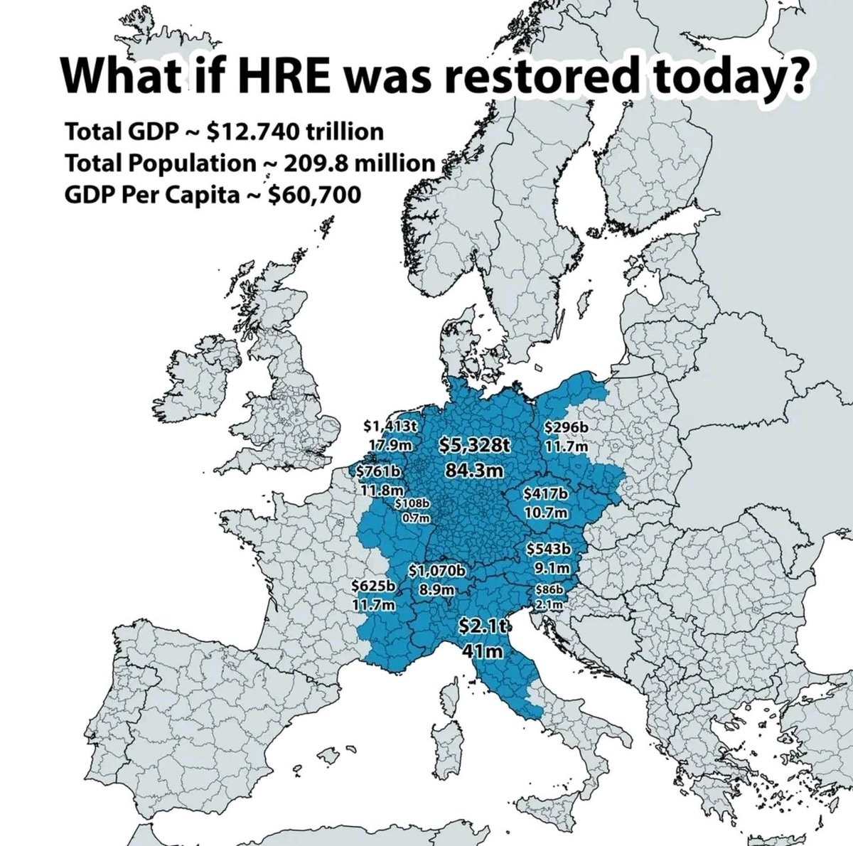 HRE restoration hypothetical
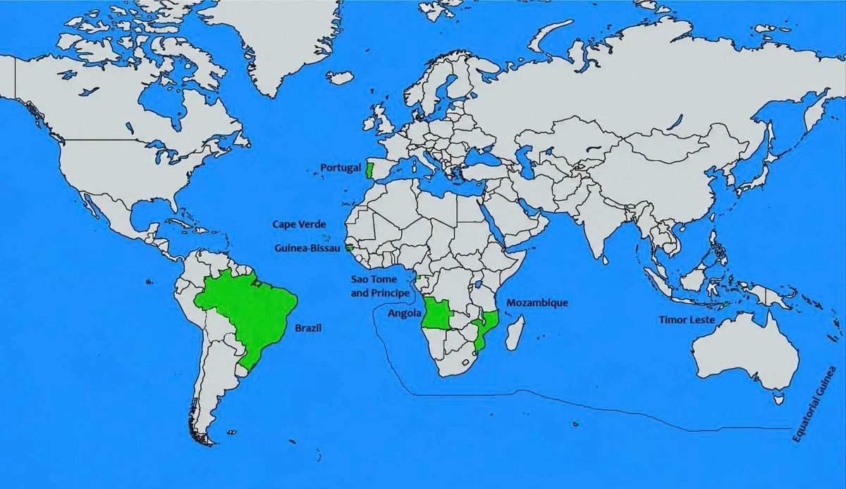 Portuguese speaking countries map
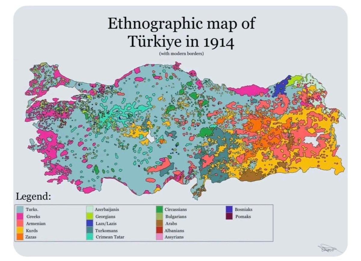 Ethnographic Map of Türkiye 1914
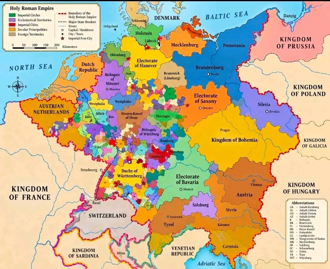 Roman Empire map 1789
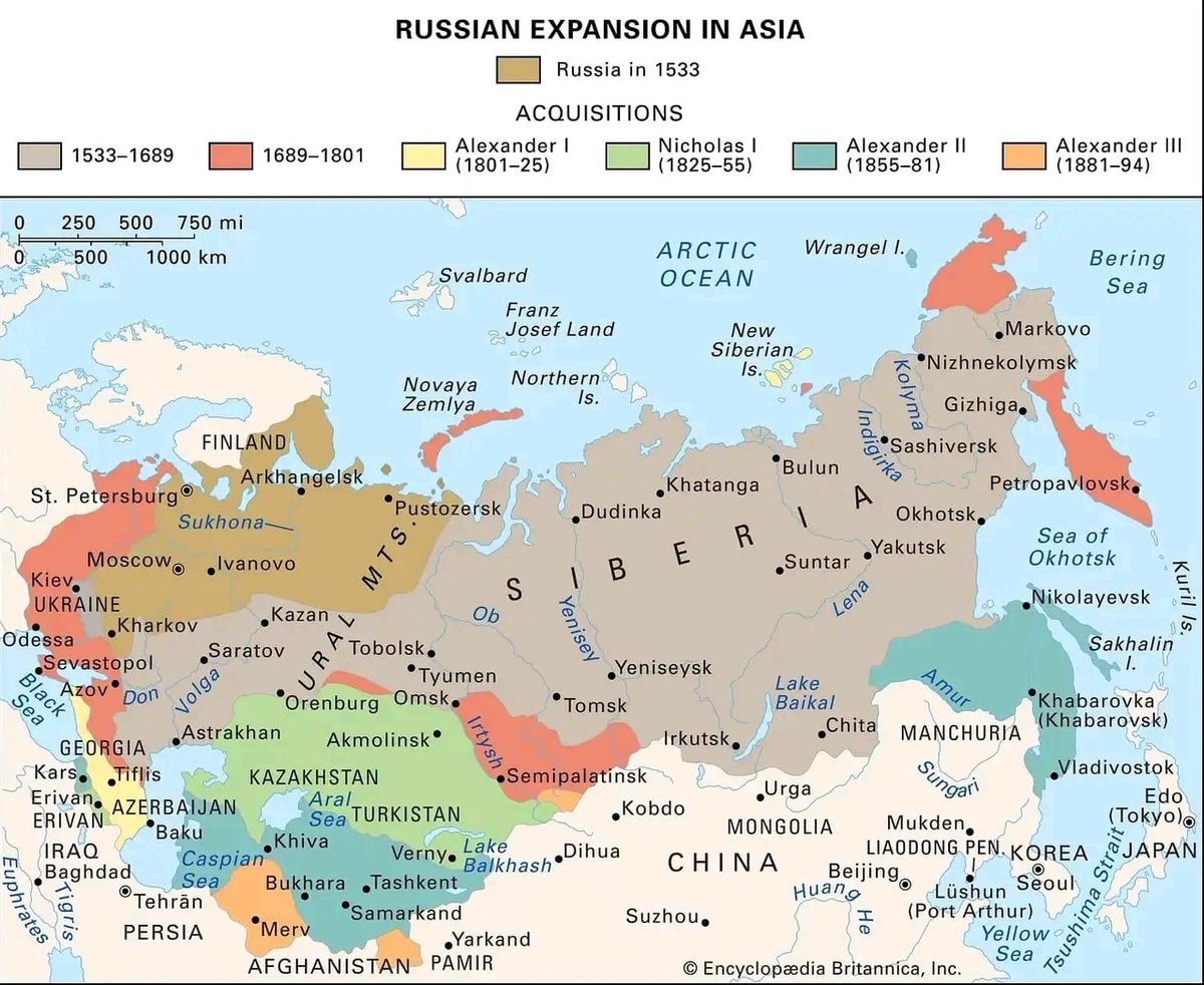 Russian Expansion in Asia 1533–1894
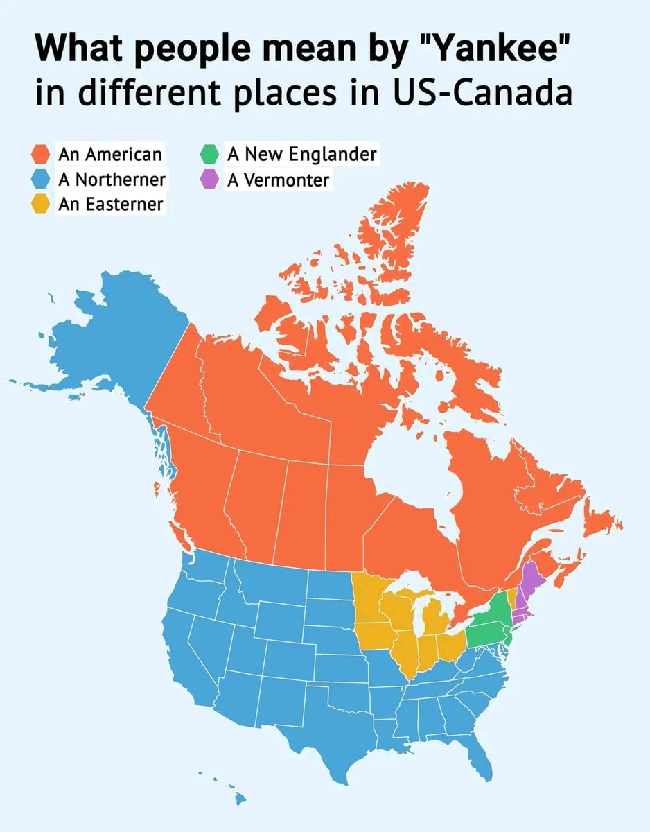 Yankee definitions map
 23 terms defined by what's missing
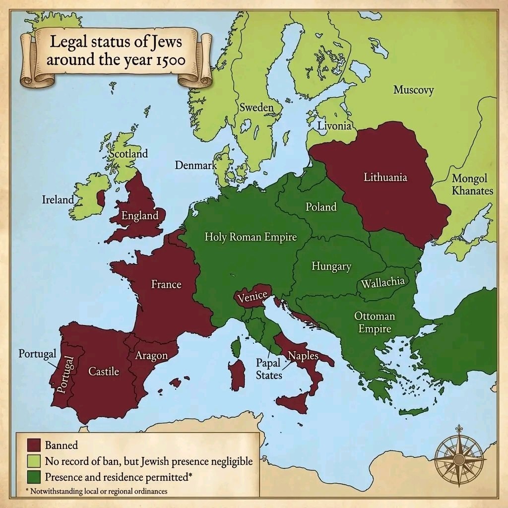 Jews in European countries 1500
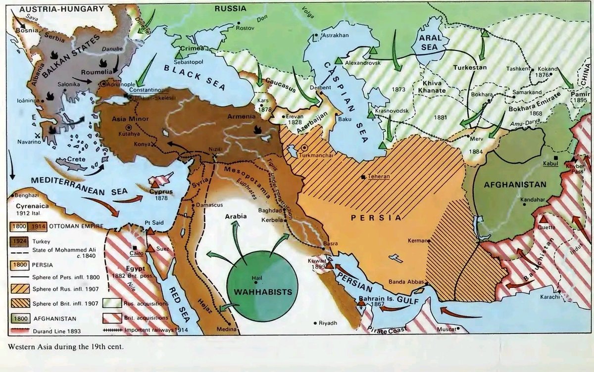 western asia 19th century map
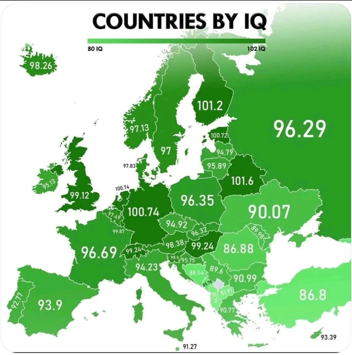 European Countries by IQ
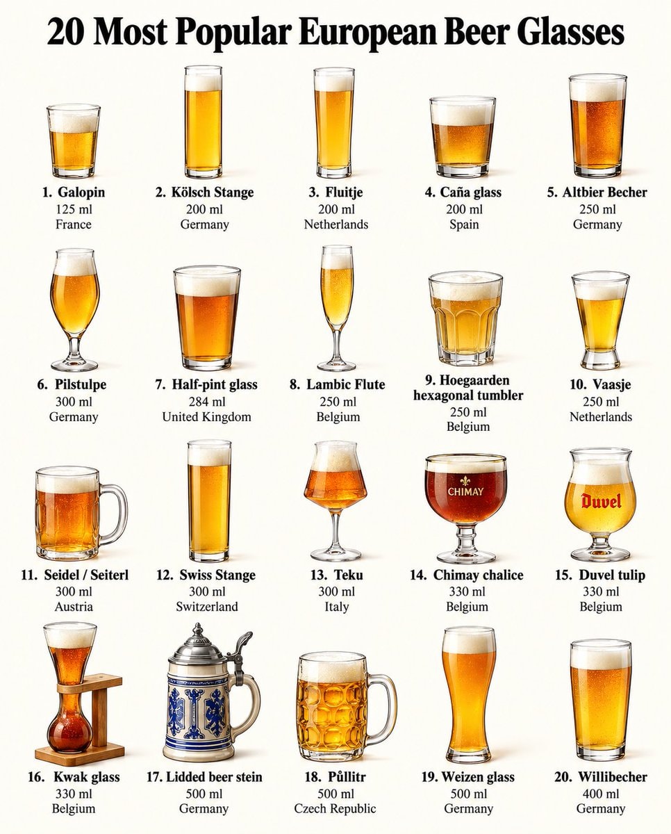 20 European Beer Glasses by Country
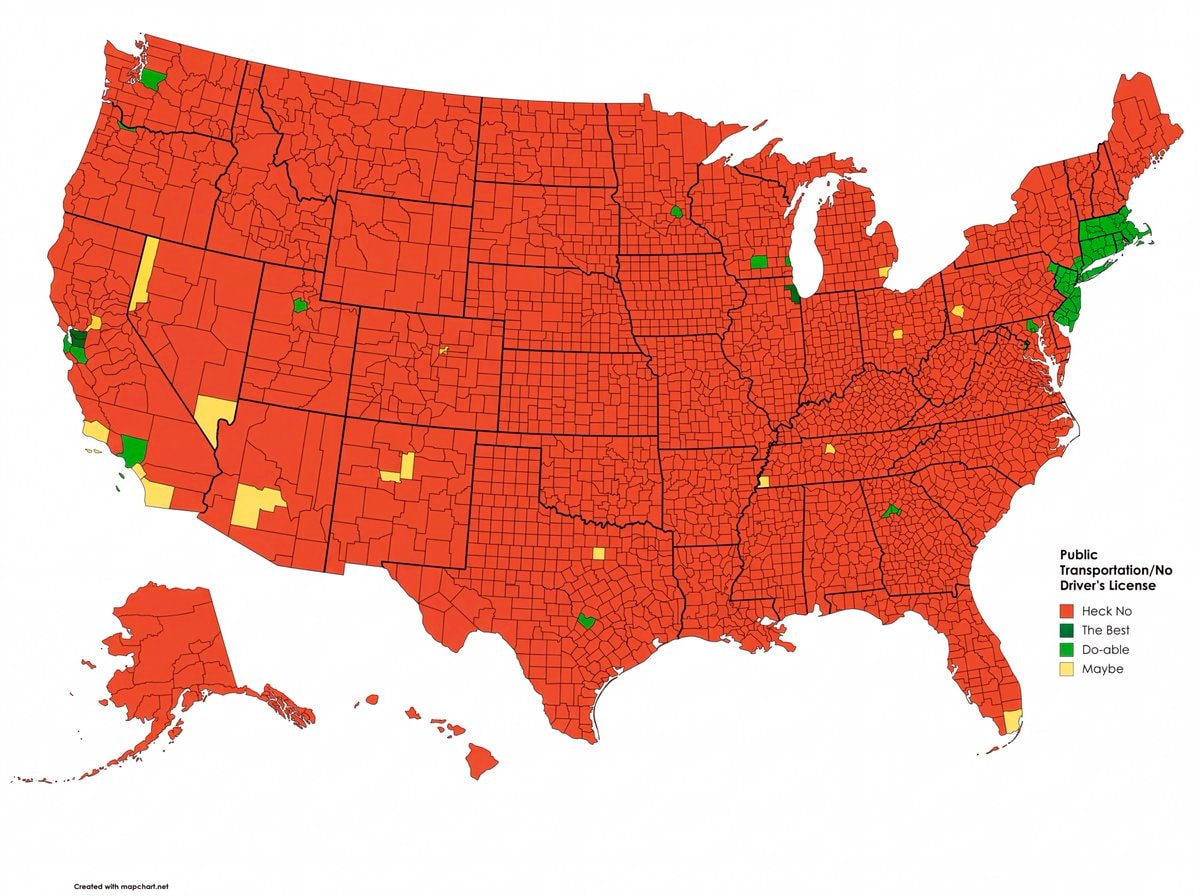 US counties livable without a driver's license
 Canada mapped by waterways
 Top 25 Most Popular Turkish Films
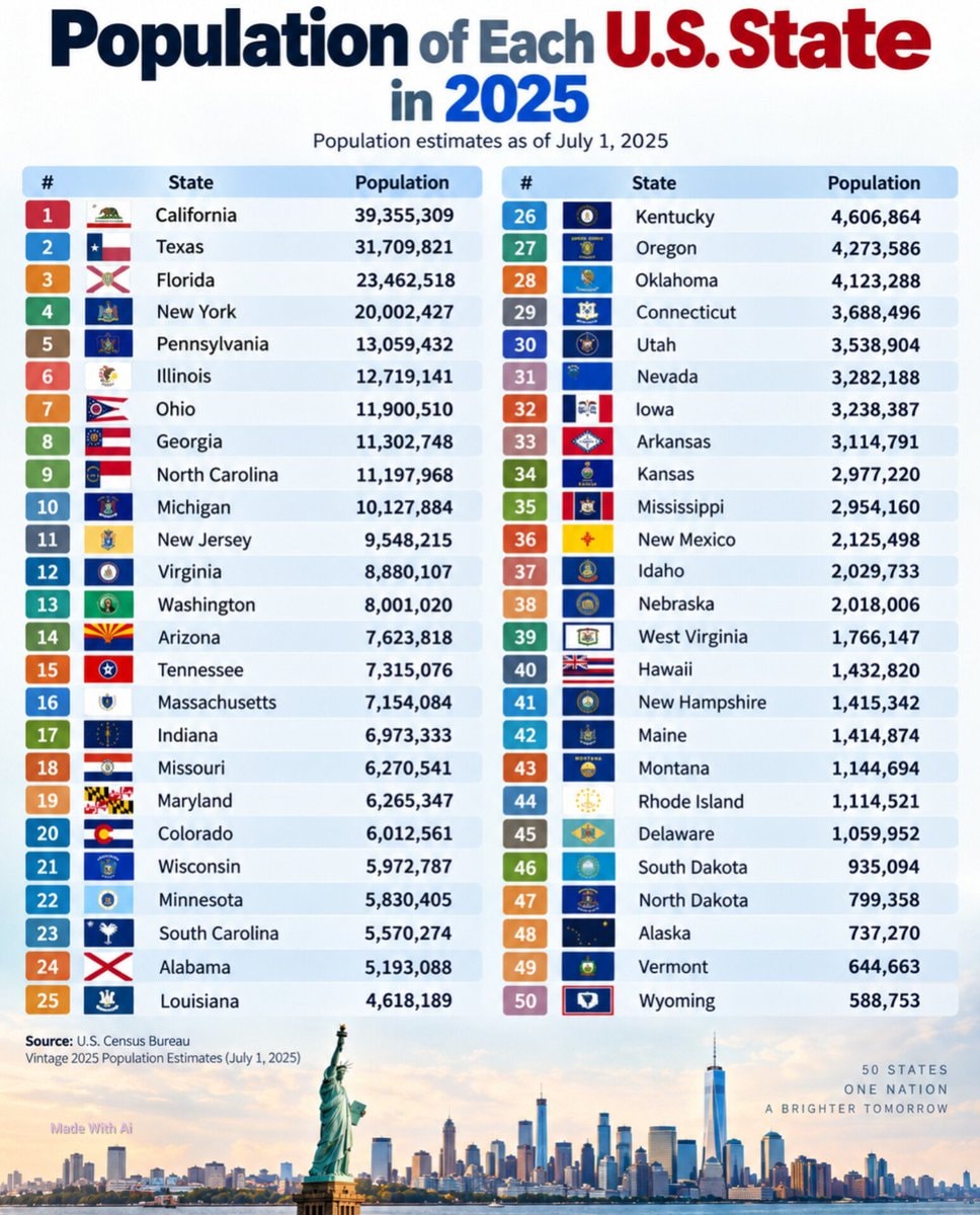 U.S. State Population Rankings 2025
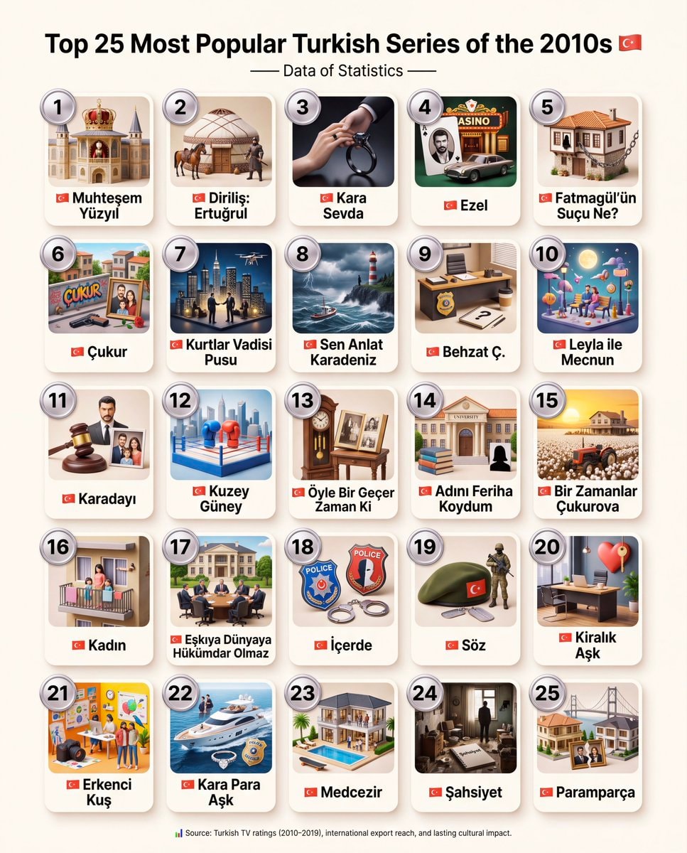 Top 25 Most Popular Turkish Series of the 2010s
@savageupdatesGermany formulated a plan for invading Western Europe in 1940
Ver publicação originalFoto de @savageupdates· Sep 27, 2026· Info/Editorials
The image is a historical map depicting military movements in Europe. Red arrows indicate German advances across Belgium and Luxembourg towards France, with tanks shown as symbols of military force. Blue lines represent Allied defenses, particularly around Paris and in northern France. The map is styled as an informational graphic, likely for educational or historical context. Notable elements include the flags of France and Germany, and the cities marked with stars, such as London, Brussels, and Paris, indicating key locations. The map is divided into sections labeled A, B, and C, with Roman numerals denoting army groups or corps.
Ainda não há comentários. Seja o primeiro!
HRE restoration hypotheticalPortuguese speaking countries mapEthnographic Map of Türkiye 1914Roman Empire map 1789Russian Expansion in Asia 1533–1894Yankee definitions map23 terms defined by what's missingJews in European countries 1500western asia 19th century mapEuropean Countries by IQ20 European Beer Glasses by CountryUS counties livable without a driver's licenseCanada mapped by waterwaysTop 25 Most Popular Turkish FilmsU.S. State Population Rankings 2025Top 25 Most Popular Turkish Series of the 2010s
Ainda não há comentários. Seja o primeiro!