
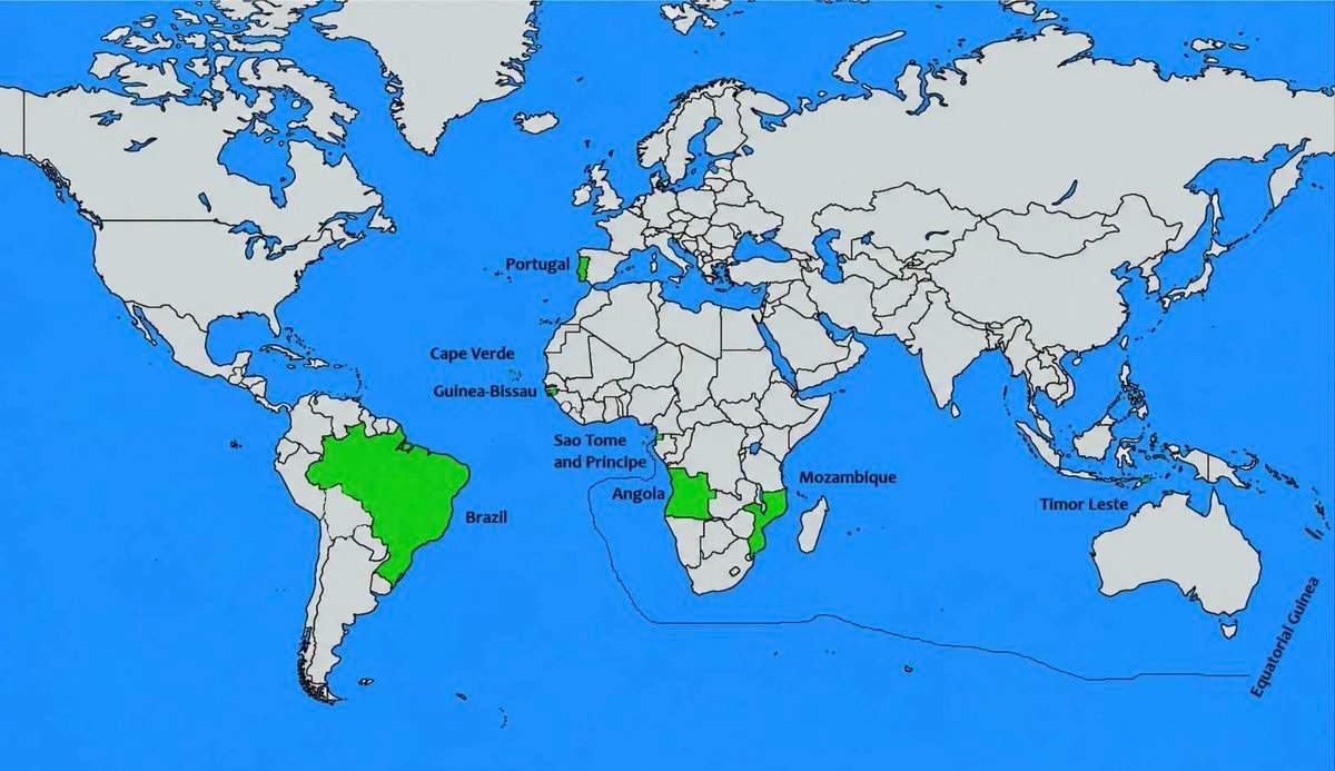
@savageupdatesNations where Portuguese is spoken
Ver publicação original@savageupdatesNations where Portuguese is spoken
Ver publicação originalFoto de @savageupdates· Sep 26, 2026· Info/Editorials
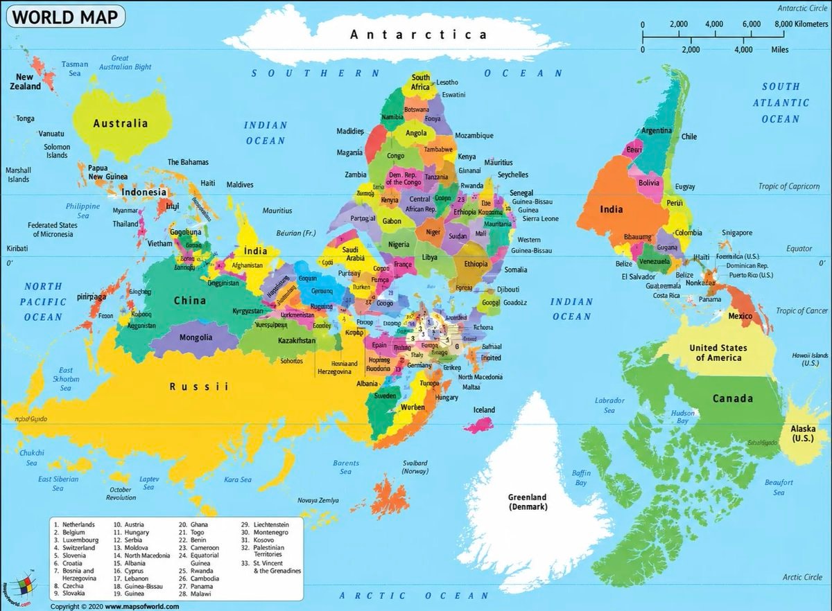
The image is a world map with several countries highlighted in green. The highlighted countries are Portugal, Cape Verde, Guinea-Bissau, Sao Tome and Principe, Angola, Mozambique, Brazil, Timor Leste, and Equatorial Guinea. The map has a clean, educational style. The green highlighting visually connects these specific nations.
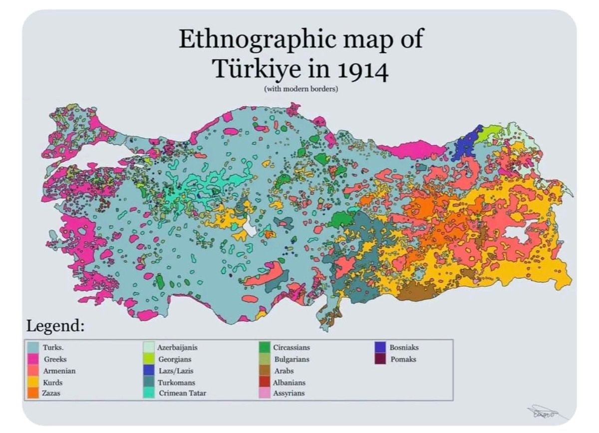 Ethnographic Map of Türkiye 1914
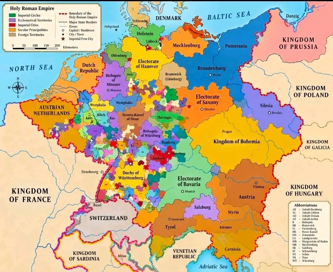 Roman Empire map 1789
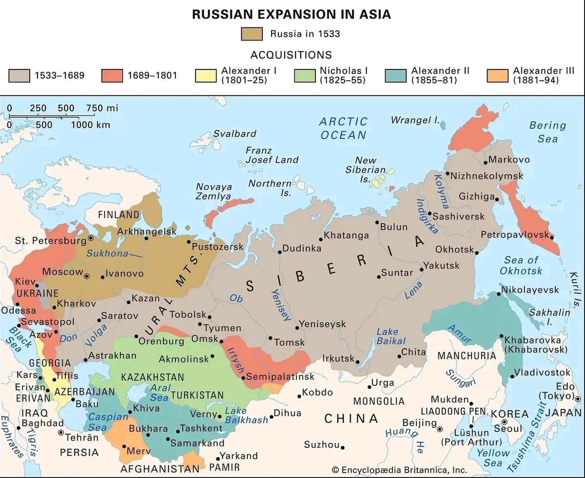 Russian Expansion in Asia 1533–1894
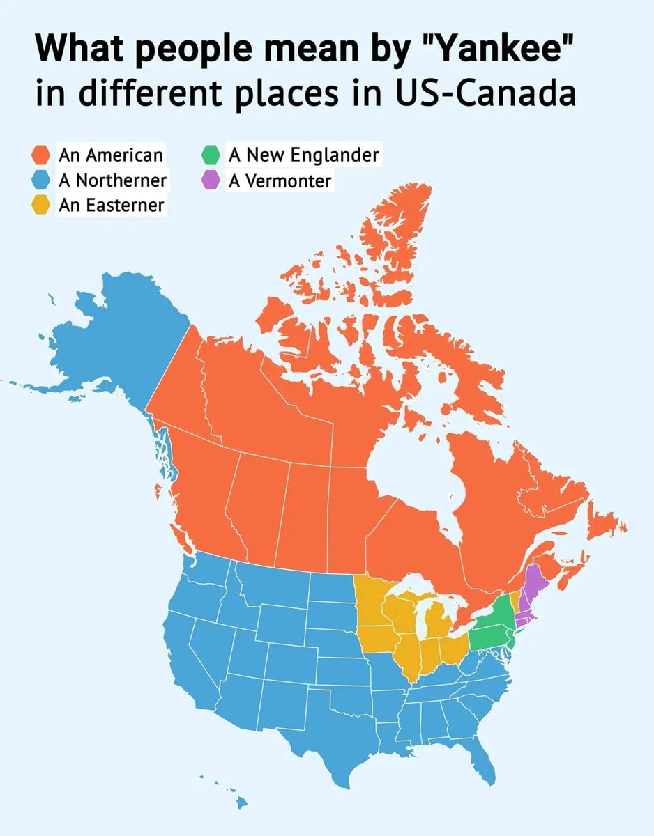 Yankee definitions map
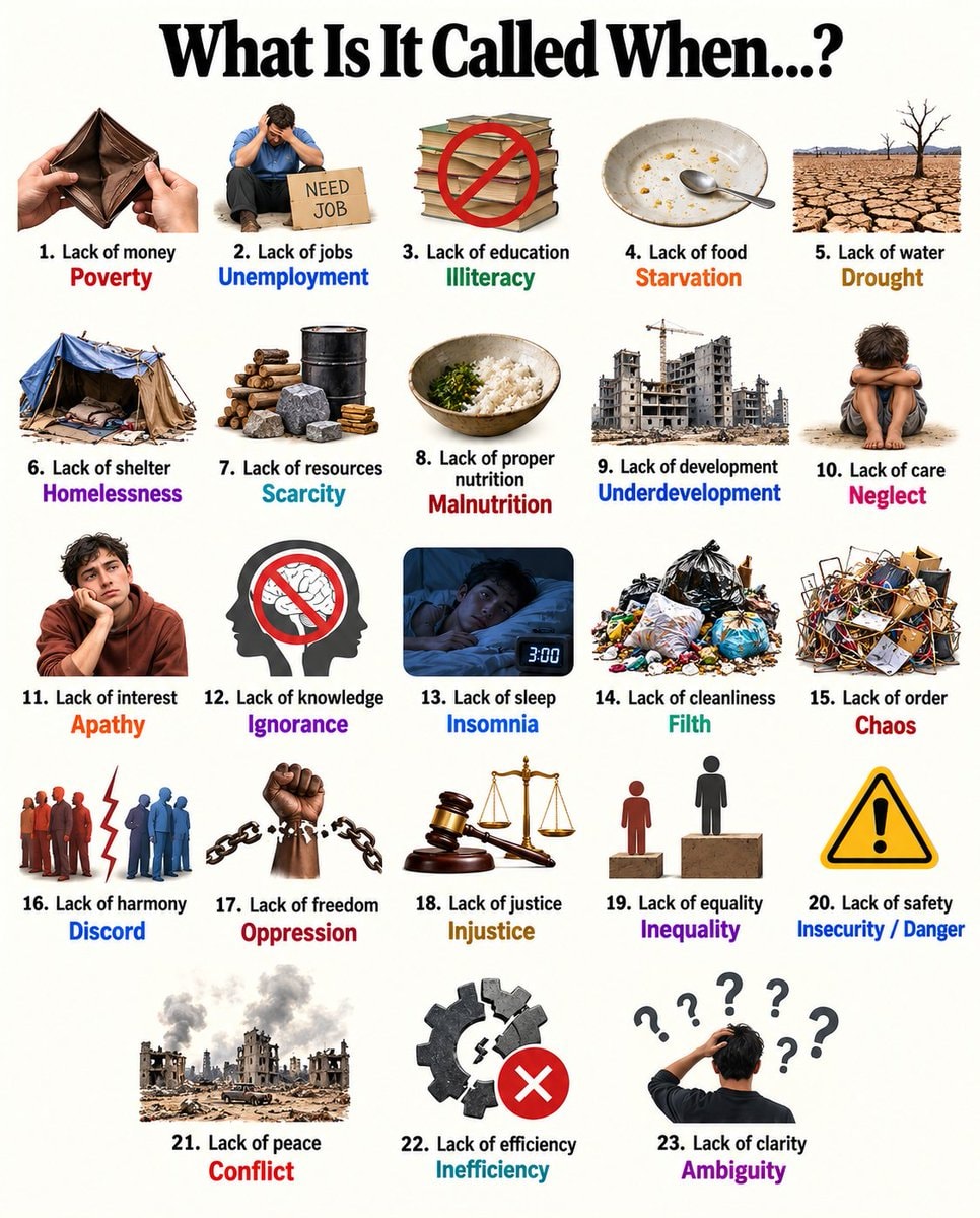 23 terms defined by what's missing
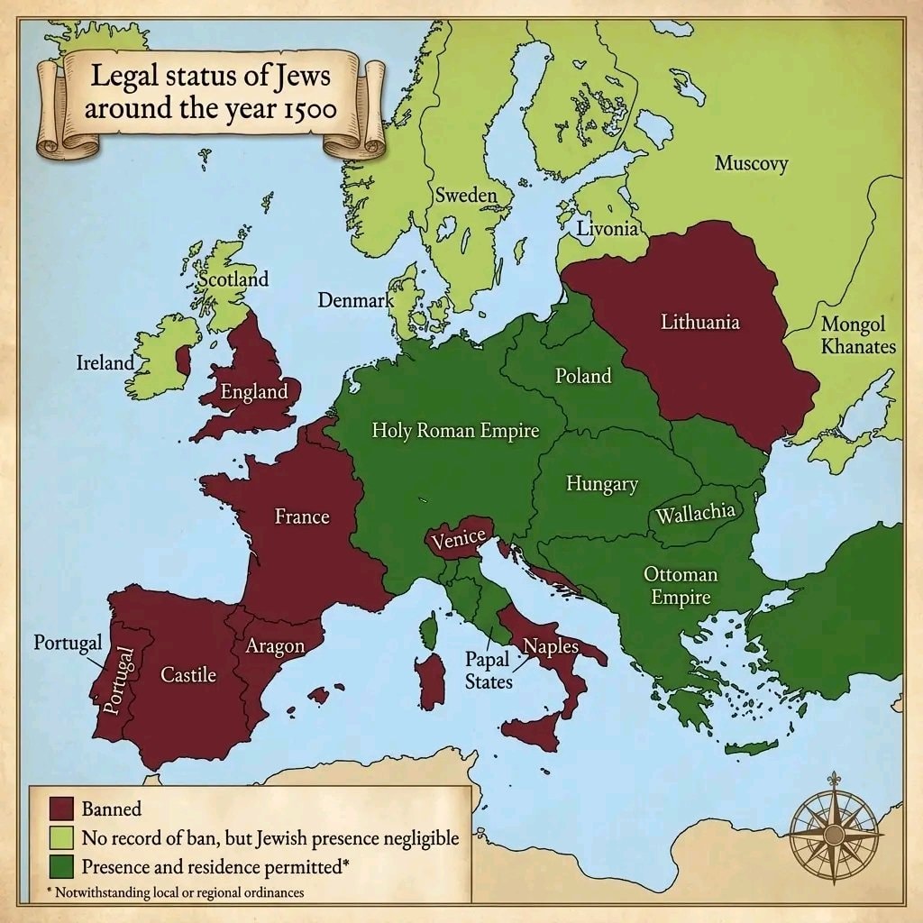 Jews in European countries 1500
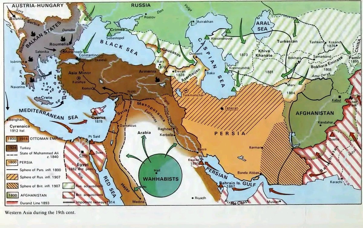 western asia 19th century map
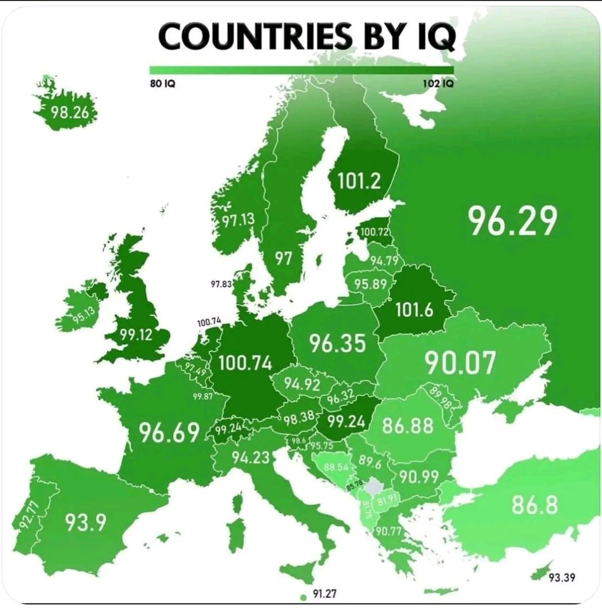 European Countries by IQ
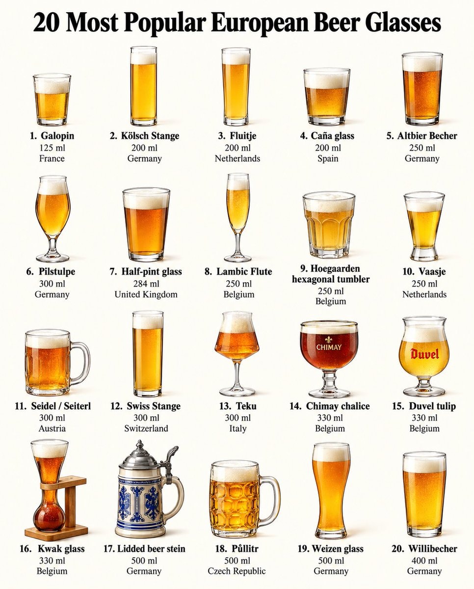 20 European Beer Glasses by Country
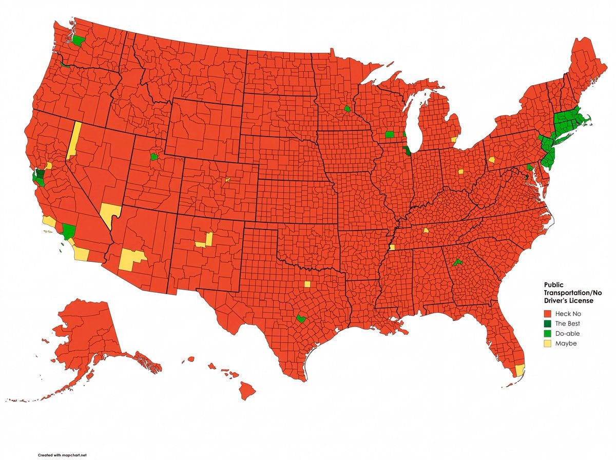 US counties livable without a driver's license
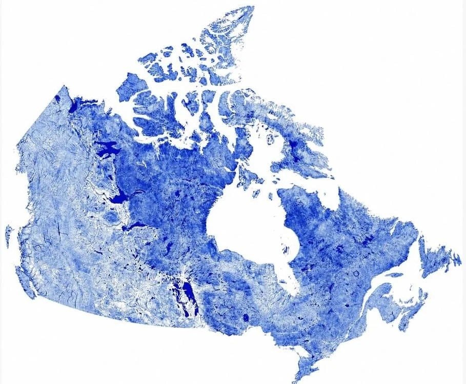 Canada mapped by waterways
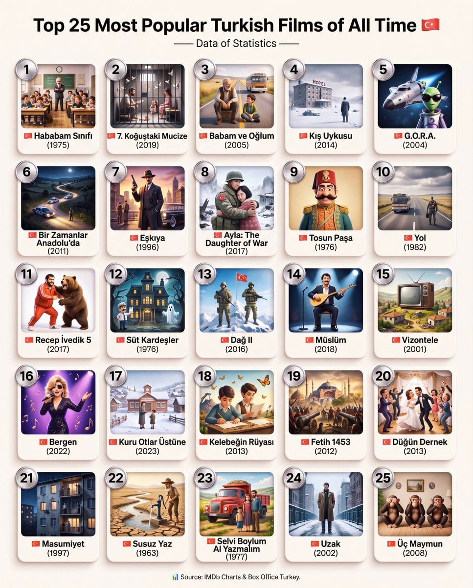 Top 25 Most Popular Turkish Films
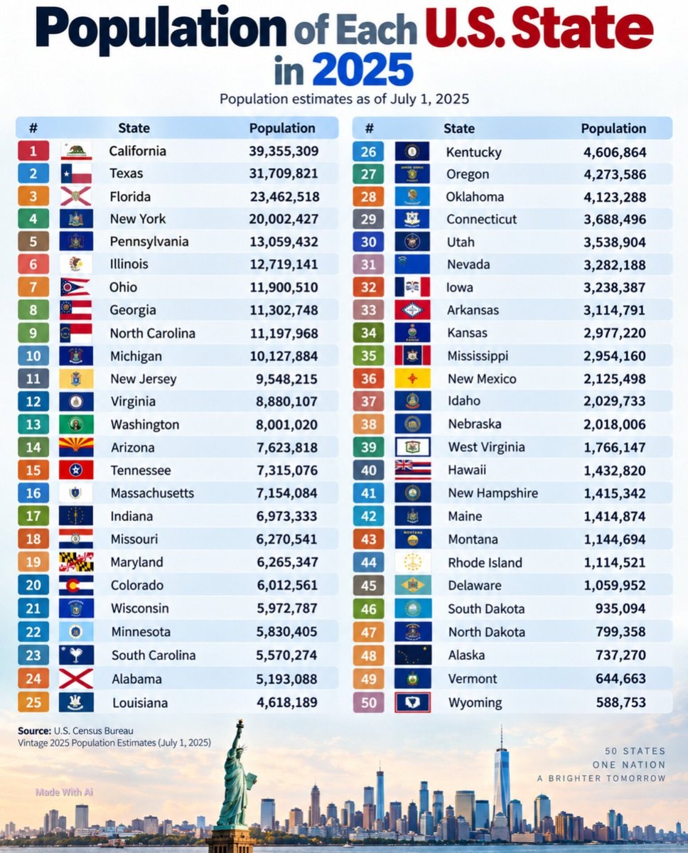 U.S. State Population Rankings 2025
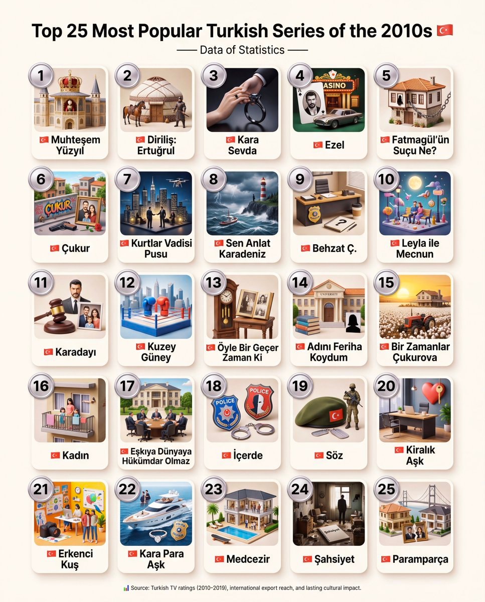 Top 25 Most Popular Turkish Series of the 2010s
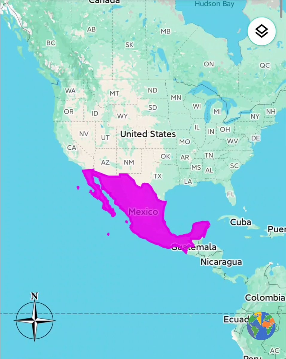 Mexico true size map
 world map visualization
@savageupdatesNations where Portuguese is spoken
Ver publicação originalFoto de @savageupdates· Sep 26, 2026· Info/Editorials
The image is a world map with several countries highlighted in green. The highlighted countries are Portugal, Cape Verde, Guinea-Bissau, Sao Tome and Principe, Angola, Mozambique, Brazil, Timor Leste, and Equatorial Guinea. The map has a clean, educational style. The green highlighting visually connects these specific nations.
Ainda não há comentários. Seja o primeiro!
Ethnographic Map of Türkiye 1914Roman Empire map 1789Russian Expansion in Asia 1533–1894Yankee definitions map23 terms defined by what's missingJews in European countries 1500western asia 19th century mapEuropean Countries by IQ20 European Beer Glasses by CountryUS counties livable without a driver's licenseCanada mapped by waterwaysTop 25 Most Popular Turkish FilmsU.S. State Population Rankings 2025Top 25 Most Popular Turkish Series of the 2010sMexico true size mapworld map visualization
Ainda não há comentários. Seja o primeiro!