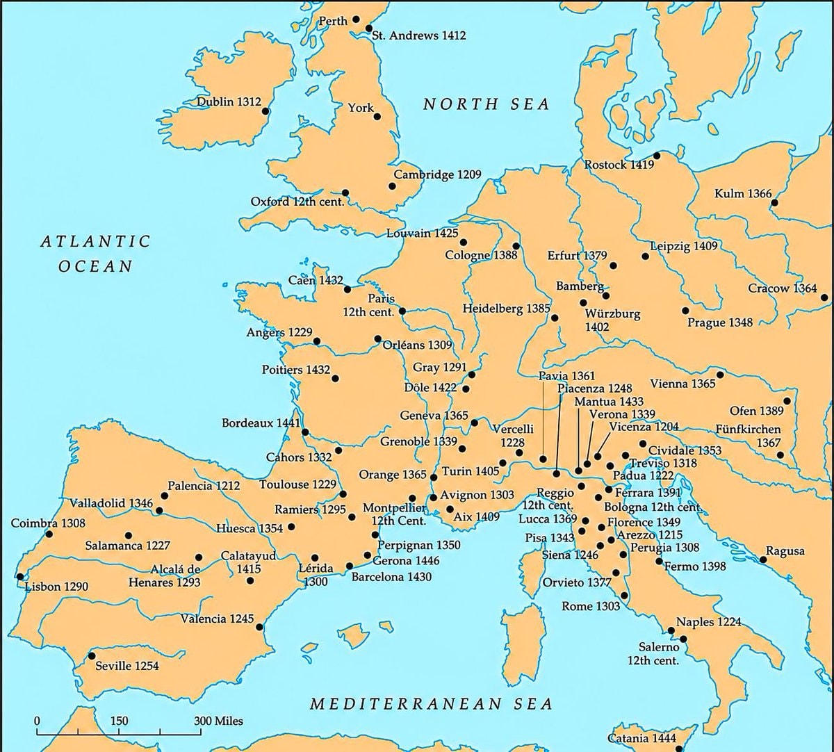
@scarlett_sWhere higher learning took root across Europe between the 12th and 15th centuries
Ver publicação original@scarlett_sWhere higher learning took root across Europe between the 12th and 15th centuries
Ver publicação originalFoto de @scarlett_s· Oct 26, 2026· Education
The image is a historical map of Europe. It shows various cities marked with black dots and labeled with their names and dates, indicating historical significance or events. The map covers Western and Central Europe, including Great Britain, France, Spain, Italy, and parts of Germany and Eastern Europe. The overall style is that of a classic educational map, with a muted color palette and clear labeling. Visually notable are the extensive labels and the geographical representation of the continent. ON-SCREEN TEXT: ATLANTIC OCEAN, NORTH SEA, MEDITERRANEAN SEA, Dublin 1312, York, Perth, St. Andrews 1412, Cambridge 1209, Louvain 1425, Cologne 1388, Erfurt 1379, Bamberg, Würzburg 1402, Rostock 1419, Kulm 1366, Leipzig 1409, Cracow 1364, Prague 1348, Paris 12th cent., Caen 143
 Average teacher salary by US state
 Jason Arday Cambridge professor
 Lila Ibrahim on degrees and AI hiring
 2Ajax Calandlyceum school at De Toekomst
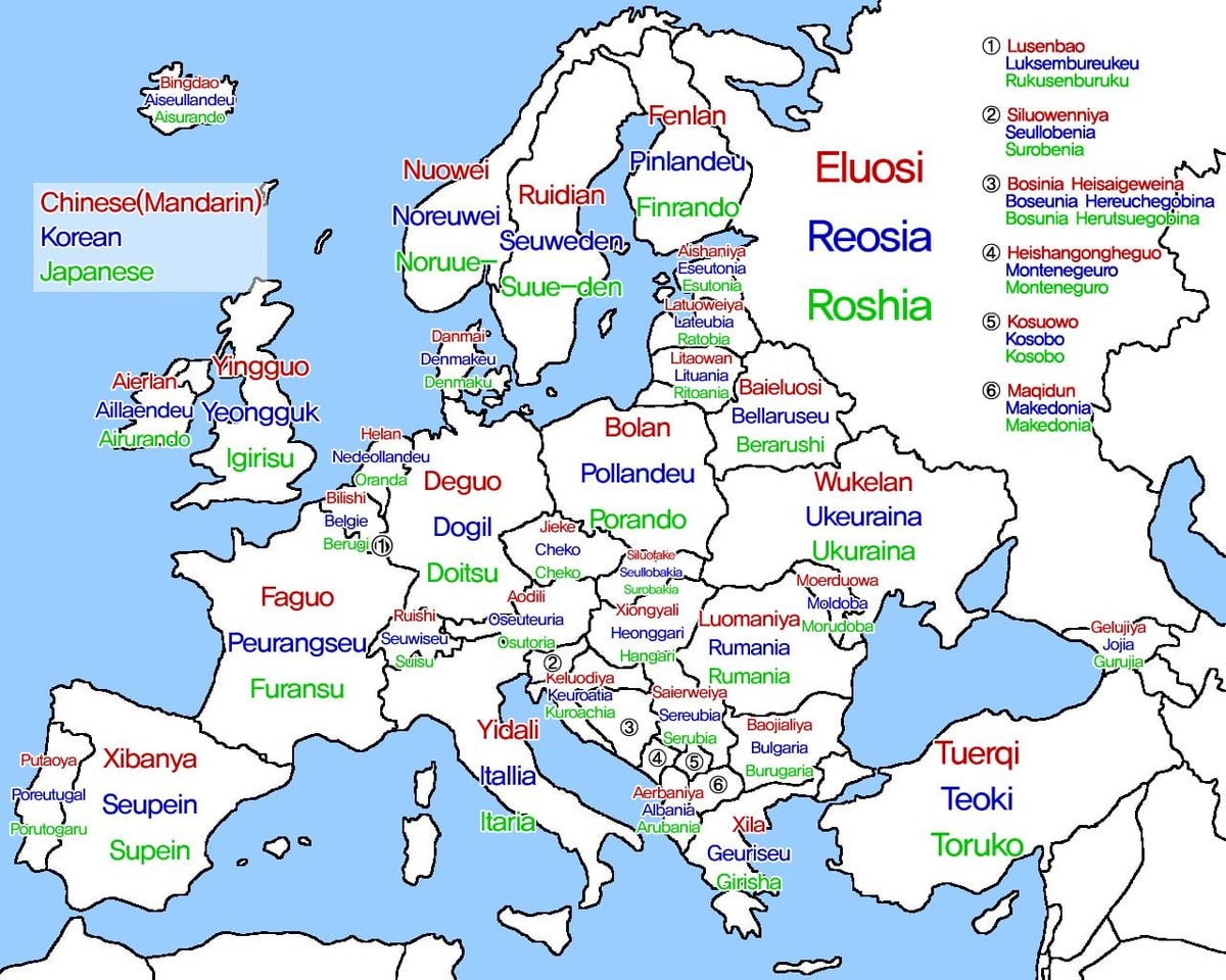 European country names in Chinese Korean Japanese
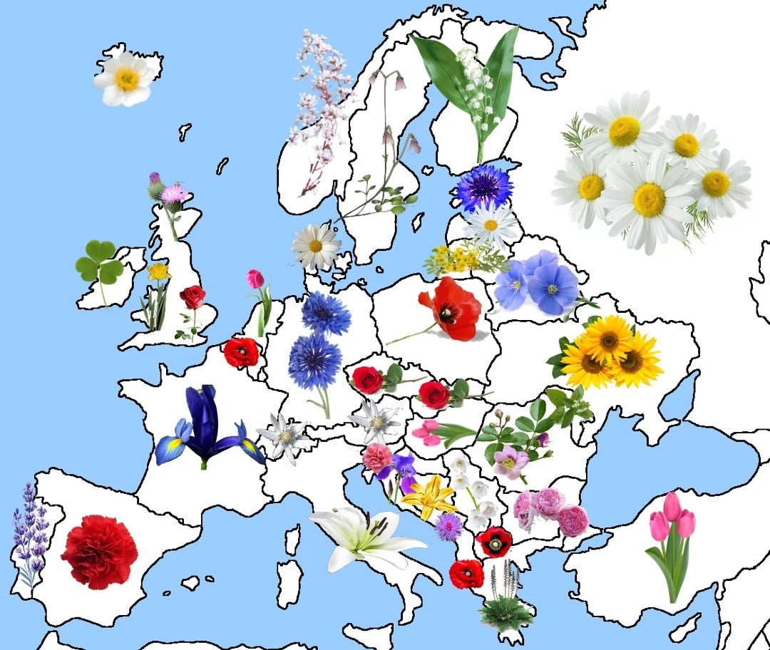 National flowers of Europe map
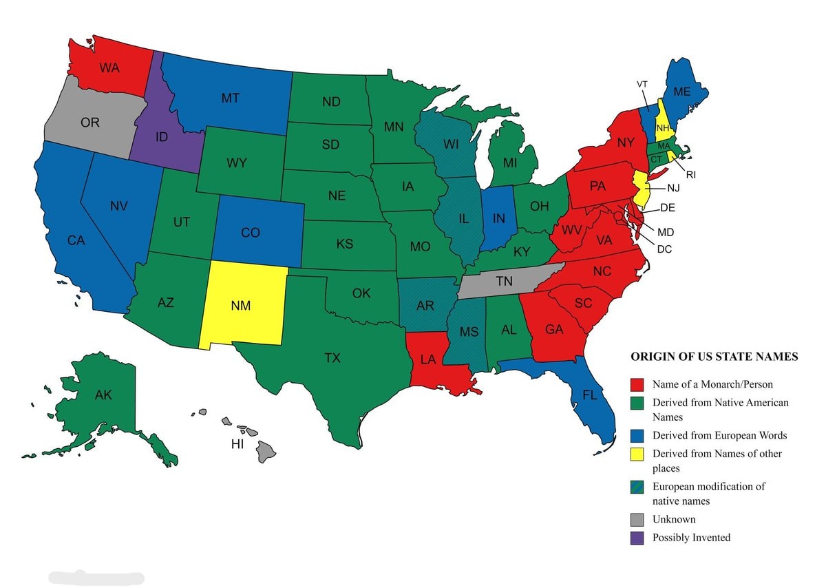 Origins of US state names map
 U.S. States Average Student Loan Debt Map
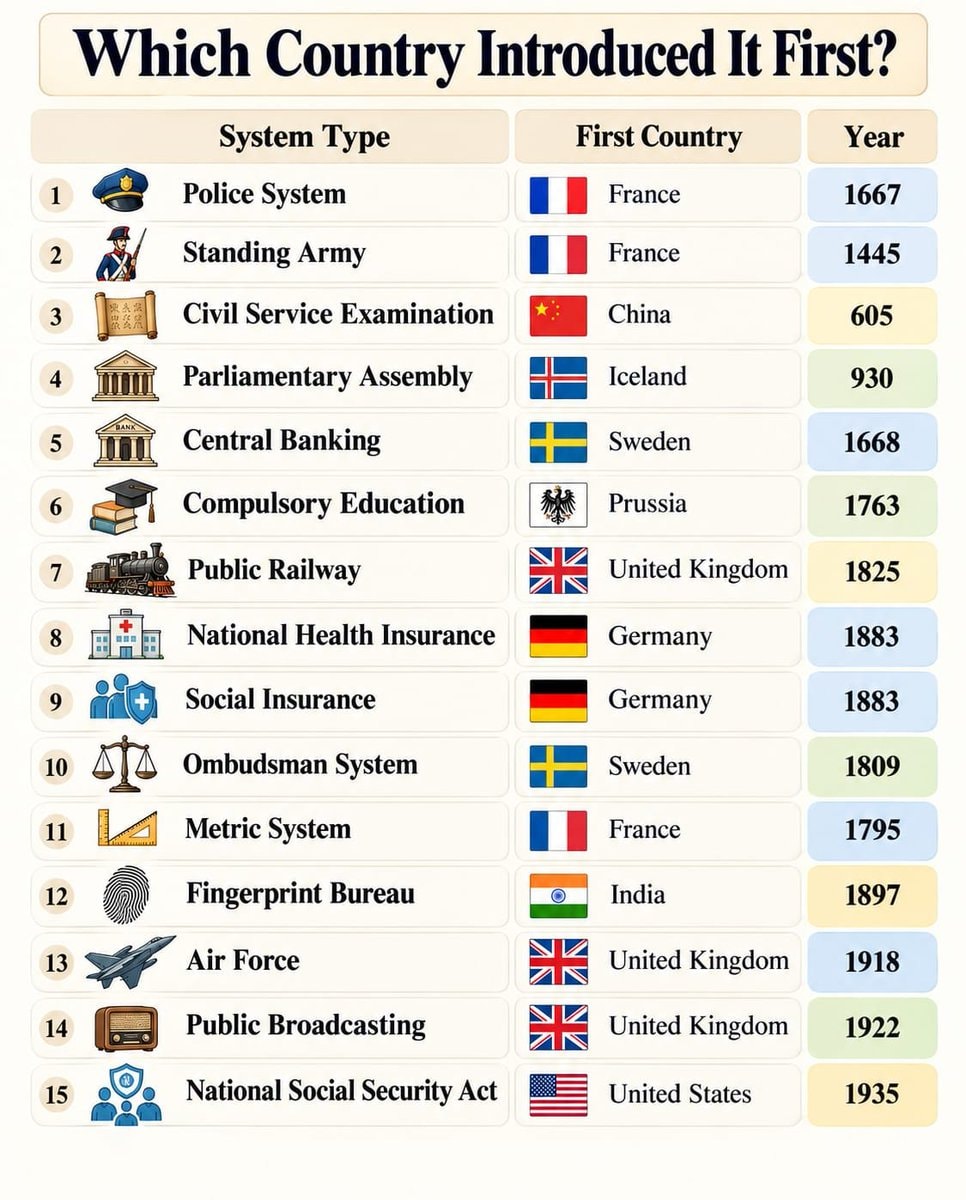 countries that introduced eleven systems first
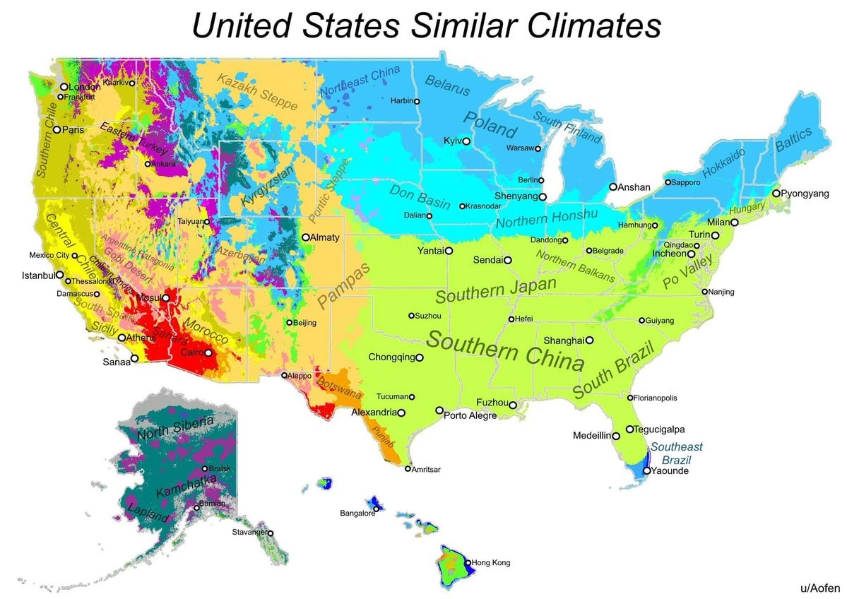 US climate match map
 handwriting brain connectivity study
 California student test failure
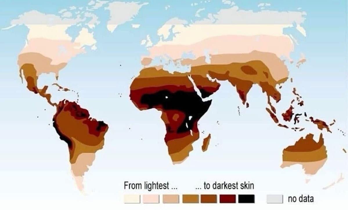 World Skin Color Map
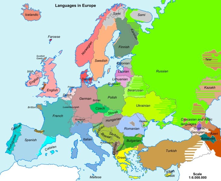 languages in Europe map
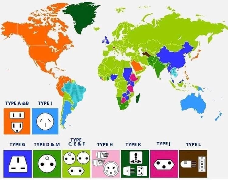 global electrical plug types map
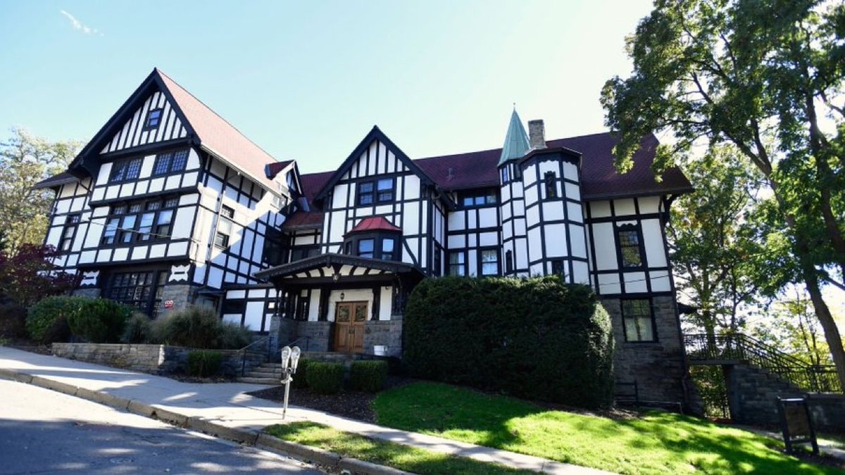 Cornell University fraternity ban
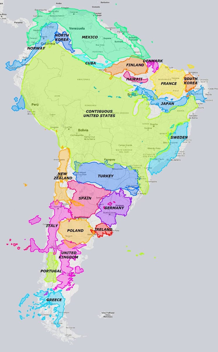 South America relative sizes map
 2Cornell University fraternity policy change
@scarlett_sWhere higher learning took root across Europe between the 12th and 15th centuries
Ver publicação originalFoto de @scarlett_s· Oct 26, 2026· Education
The image is a historical map of Europe. It shows various cities marked with black dots and labeled with their names and dates, indicating historical significance or events. The map covers Western and Central Europe, including Great Britain, France, Spain, Italy, and parts of Germany and Eastern Europe. The overall style is that of a classic educational map, with a muted color palette and clear labeling. Visually notable are the extensive labels and the geographical representation of the continent. ON-SCREEN TEXT: ATLANTIC OCEAN, NORTH SEA, MEDITERRANEAN SEA, Dublin 1312, York, Perth, St. Andrews 1412, Cambridge 1209, Louvain 1425, Cologne 1388, Erfurt 1379, Bamberg, Würzburg 1402, Rostock 1419, Kulm 1366, Leipzig 1409, Cracow 1364, Prague 1348, Paris 12th cent., Caen 143
Ainda não há comentários. Seja o primeiro!
Average teacher salary by US stateJason Arday Cambridge professorLila Ibrahim on degrees and AI hiring2Ajax Calandlyceum school at De ToekomstEuropean country names in Chinese Korean JapaneseNational flowers of Europe mapOrigins of US state names mapU.S. States Average Student Loan Debt Mapcountries that introduced eleven systems firstUS climate match maphandwriting brain connectivity studyCalifornia student test failureWorld Skin Color Maplanguages in Europe mapglobal electrical plug types mapCornell University fraternity banSouth America relative sizes map2Cornell University fraternity policy change
Ainda não há comentários. Seja o primeiro!