
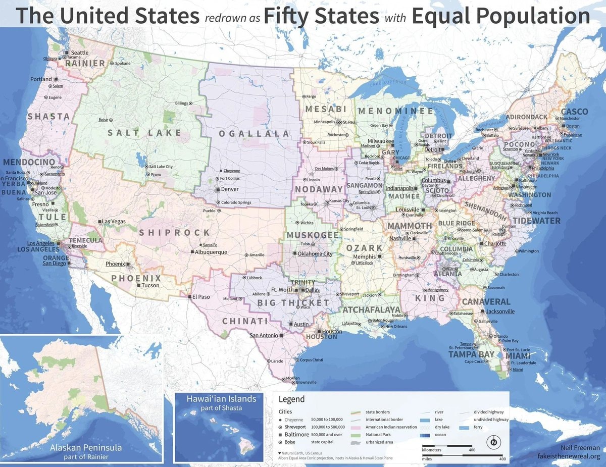
@taikiA hypothetical map showing the United States with fifty states of equal population
Ver publicação original@taikiA hypothetical map showing the United States with fifty states of equal population
Ver publicação originalFoto de @taiki· Aug 30, 2026· United States
The image is a map of the United States. The map is stylized to show the country redrawn into fifty states of equal population. The map includes labels for new state names like "Rainier," "Shasta," "Mendocino," "Tule," "Temecula," "Orange," "Phoenix," "Shiprock," "Big Thicket," "Chinati," "Atchafalaya," "King," "Canaveral," "Tampa Bay," "Miami," "Tidewater," "Shenandoah," "Allegheny," "Blue Ridge," "Columbia," "Mammoth," "Blue Ridge," "Ozark," "Muskogee," "Nodaway," "Sangamon," "Maumee," "Detroit," "Firelands," "Gary," "Mesabi," "Menominee," "Ogallala," and "Adirondack." There are also inset maps showing the Hawaiian Islands and the Alaskan Peninsula. A legend explains the map's symbols and colors. The title at the top reads "The United States redrawn as Fifty
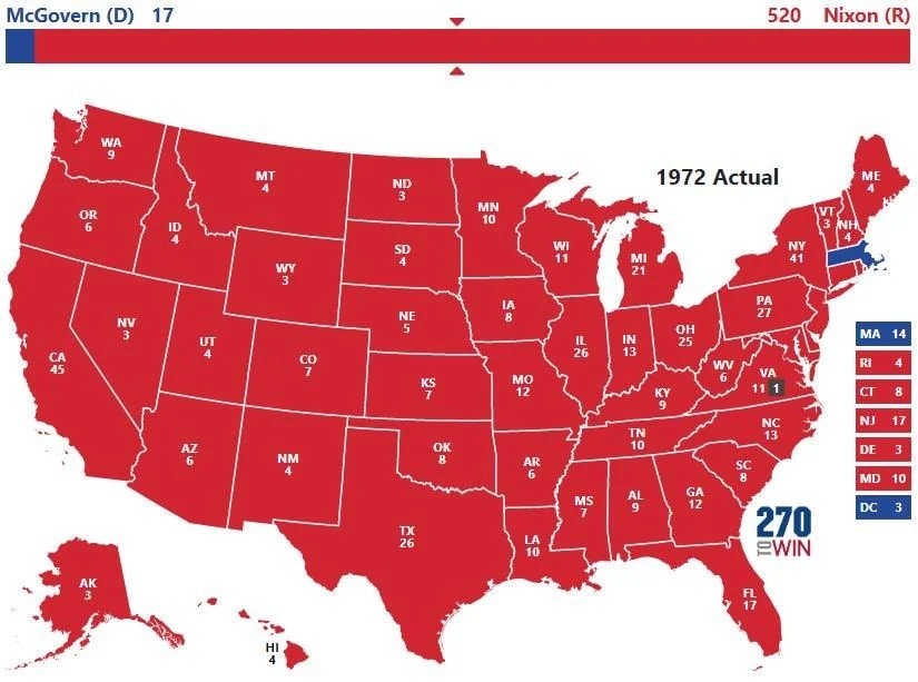 1972 US presidential election map
 2Toys R Us store expansion
 2US Republicans foreign piracy site ban bill
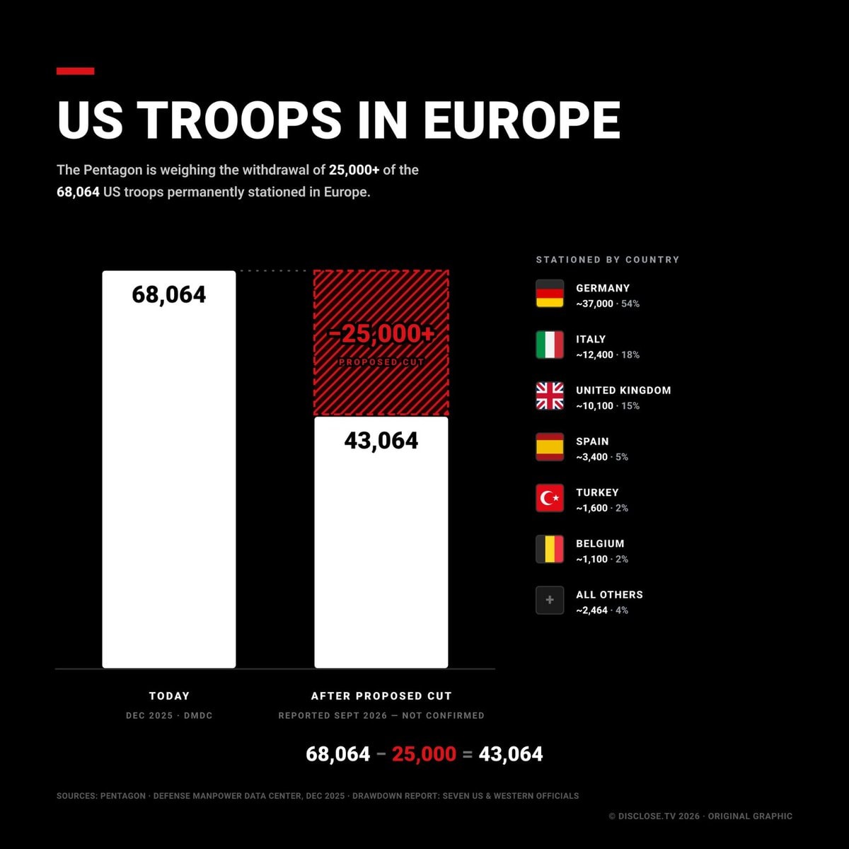 2US Troops in Europe proposed cuts
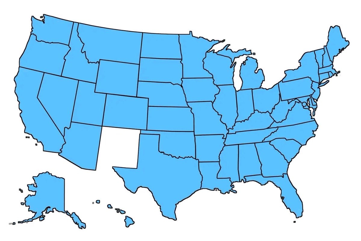 United States old states map
 most common US road suffixes by county
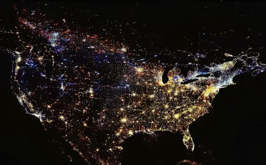 United States at night
 2China US outer space legal gap
 Brazil U20 Women's World Cup Quarterfinals
 Crypto Clarity Act Senate vote
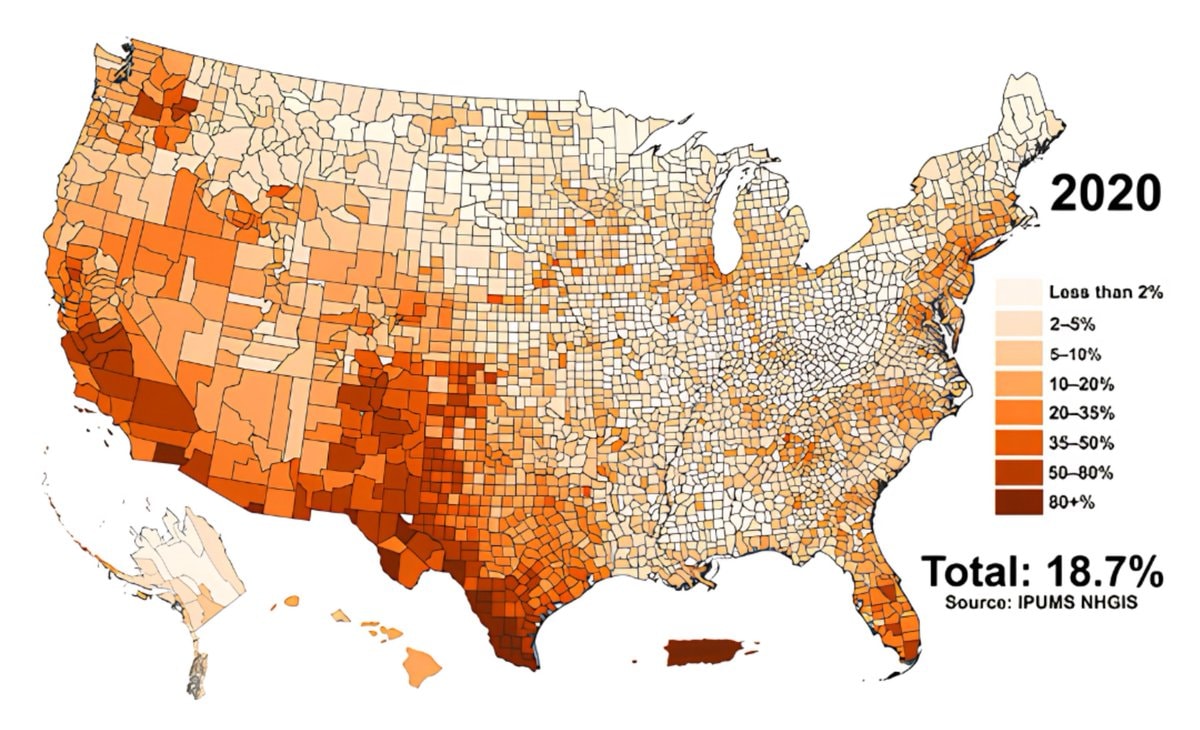 Hispanic population share by U.S. county
 Alex Saab pleads guilty in Miami
 2US Space Force orbital weapons
 US Space Force deploys on-orbit weapons
 US government term limits critique
 2US Navy aircraft carrier
 2Strategic Bitcoin Reserve bill committee vote
 iPhone 18 contract pricing in South Africa
@taikiA hypothetical map showing the United States with fifty states of equal population
Ver publicação originalFoto de @taiki· Aug 30, 2026· United States
The image is a map of the United States. The map is stylized to show the country redrawn into fifty states of equal population. The map includes labels for new state names like "Rainier," "Shasta," "Mendocino," "Tule," "Temecula," "Orange," "Phoenix," "Shiprock," "Big Thicket," "Chinati," "Atchafalaya," "King," "Canaveral," "Tampa Bay," "Miami," "Tidewater," "Shenandoah," "Allegheny," "Blue Ridge," "Columbia," "Mammoth," "Blue Ridge," "Ozark," "Muskogee," "Nodaway," "Sangamon," "Maumee," "Detroit," "Firelands," "Gary," "Mesabi," "Menominee," "Ogallala," and "Adirondack." There are also inset maps showing the Hawaiian Islands and the Alaskan Peninsula. A legend explains the map's symbols and colors. The title at the top reads "The United States redrawn as Fifty
Ainda não há comentários. Seja o primeiro!
1972 US presidential election map2Toys R Us store expansion2US Republicans foreign piracy site ban bill2US Troops in Europe proposed cutsUnited States old states mapmost common US road suffixes by countyUnited States at night2China US outer space legal gapBrazil U20 Women's World Cup QuarterfinalsCrypto Clarity Act Senate voteHispanic population share by U.S. countyAlex Saab pleads guilty in Miami2US Space Force orbital weaponsUS Space Force deploys on-orbit weaponsUS government term limits critique2US Navy aircraft carrier2Strategic Bitcoin Reserve bill committee voteiPhone 18 contract pricing in South Africa
Ainda não há comentários. Seja o primeiro!